Thursday, November 24, 2022

Reflections on Granite

Granite again? Well, yes, and when I think about it, I hear the Eagles enthusiastically singing “Take it to the limit. One more time.” This last hike was my thirteenth time (actually 13 ½ if you count that ignominious episode when I got caught out in a downpour halfway up and without rainwear). Probably a modest number of ascents when compared to others, but a baker’s dozen is nonetheless a magic number.

I remember a year's earlier ascent in late June. We experienced a brilliant sunny day with wildflowers blooming, including a profusion of lupine, Indian paintbrush, columbine, and Beargrass blossoms. And, once past the high-angled meadows, we encountered the first snow fields and the trail became indistinct. Once at the steep ridge to the fire lookout, we had the choice of scrambling up through a jagged jumble of granite blocks or taking the snowfield. We opted for the granite and soon regrated that decision. While the upper granite near the lookout has more flat blocks and is easily navigable the lower sections are a mess of large sharp blocks jutting every which way with no obvious clear path other than up. It was hugely frustrating, consuming lots of time, and we almost bailed on the hike. “You know we don’t have to go to the top.” “I know.” Having acknowledged that, we then kept on up the granite for a bit longer and then stepped off to the snowfields, kicked steps, and continued up. It was a glorious sunny day with Mt. Rainier and Mt. Stuart clearly visible. We spent about half an hour having lunch and visiting with other hikers at the historic lookout. A day to remember.

Another memorable trip was the result of my fascination with night sky photography. I was looking for dark sky photo opportunities and conceived a Granite Mountain Galaxy Quest to achieve the photographic equivalent of a first ascent. Being familiar with the site, having hiked to it several times before, I previsualized the composition with the relative positions of the fire lookout, Mount Rainier, and the Galactic Core. Then, I contacted some friends to share the adventure with and we waited for the right conditions to come together.

Mark and Chase jumped at the chance when I invited them to join me on a hike up Granite Mountain to photograph the Galactic Core of the Milky Way. Then we hiked. Packing photo gear and overnight kit up 3,820 vertical feet was brutal but soon forgotten as we dined on Mark’s scratch-made smoked turkey sausage camp stew and settled in for the light show. I worked the camera into the dark as the GC appeared in the southern skies over Mt. Rainier.

There was no campground. It was a bivouac situation. We needed to shoot late into the night sky and then either hike out in the dark with headlamps after the shoot or pack sleeping bags and pads and bivy until dawn and then hike out in the daylight. Because of the potential for injury hiking out in the dark on this trail we elected to bivy. I got 3, maybe 4 hours of sleep, but it was worth it!

Waking at dawn, we reluctantly packed up and hiked down from the site of the night sky magic. We counted 102 people coming up Sunday morning as we descended (even before the Pratt Lake Trail intersection). Party up top! We decided to award a mini chocolate bar to number 100 and since the universe is a strange place, number 100 was a woman who Mark had worked with at K2. Of course, Diane was delighted with the chocolate prize and seeing her old friend Mark again. Really. You can't make this stuff up. Trip verdict? Priceless!!!

I have reflected that the hikes to Granite Mountain Lookout are always a standout experience as the changing seasons offer a continuing opportunity to experience the scenery in new and ever-fascinating ways. The hike is at once both comfortingly familiar and yet intriguingly new, like reconnecting with a long-lost old friend.

So why was I now hiking it again? It was both the lure of fall color and the need for wooden shingles. The Snoqualmie Fire Lookouts Association was seeking volunteers to carry wood shingles up to the lookout for a roof repair (after last week's llamas flamed out after a mile last week). I almost went for the llamas, but didn’t. Who wants to be stuck behind a pack train for four miles, no matter how cute the animal? I would wait. And now, while I equivocated about the possibility of being part of a conga line of happy hikers with shingles (wood shingles), I decided to be a part of it. It was an opportunity to give back and maybe meet some fun people.

I snagged one of the last parking spaces in the lot at 7:40 am, and after some milling around as folks unloaded the shingle packets from a truck, I moseyed up, signed the register, and picked a bundle. I found a medium-sized packet that slid snugly into my 50-liter pack. There were no coffee gift cards. But they did have homemade chocolate chip cookies, which I forgot to sample. I just wanted to get going in the cool of the morning, before the inevitable heat that would come later in the day.

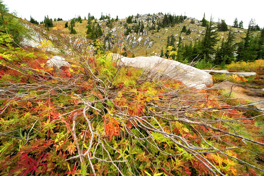
The first two miles of the trail in the shady wooded section were the usual study in browns and greens, almost monochrome. The dusty trail snaked up the mountain meandering through ever-steeper rocky sections. The first mile is easy and then, after the trail split, the rocky route gets down to business. This is the section where I’m still warming up and I’m asking myself why I ever thought this was a good idea. Why indeed? Well, it’s for those gorgeous upper mountain meadows that are festooned with Beargrass blossoms in the early season and aflame with color in the fall. It always takes my breath away.

I was surprised that there was no conga line and not surprised that I met some interesting fellow hikers. After breaking out of the woods, I made my way up through the meadows, which I regard as the best part of the hike. The arduous earlier ascent would be behind, and while there is still much elevation to be gained, it’s far more pleasurable. Yes, the trail is still chockablock with boulders but this section flows upward, and I feel as if I am dancing with granite, as the sheer magic of the hike reveals itself. This is the place where you can go faster but you are best served if you slow down and let the magnificent scenery just wash over you. Today we hiked through a heart-stopping visual symphony of fall color. I could hear Wagner’s dramatic operatic ‘Flight of the Valkyries.’ I didn’t want it to end, and yet we had more work to do.

We continued on the summer route to avoid the boulder-strewn ridgeline and ascended the tedious backside switchbacks up to the final rocky ramp to the iconic Granite Mountain Lookout. Always a visual treat!

After handing off our shingle packets, which were immediately taken up into the lookout, we found places to sit and refuel. Even after hiking slowly with frequent pauses to sip water, I was surprised to note that I had arrived in 3 hours and 15 minutes. It felt slower than that, more like four hours. By now it was quite warm and the skies were clear for miles, four volcanoes visible from the lookout. Even Mt. Stuart made an appearance. The vibe was friendly and festive, with groups of hikers savoring the day. I felt suspended in time as Elizabeth made a summit espresso which she drank from a tiny stainless cup, the silhouette of mighty Mt. Rainier visible in the background as thin clouds streaked across the horizon. What a day! This is why we do it.

As I descended, I encountered many more shingle-laden hikers on the way up, some complaining about the strenuousness of the hike. Hey, as one seasoned hiker observed in a trip report from long ago, “No matter how fit you are, Granite always kicks your butt.” Why is it so I asked myself? I think it goes beyond mere stats of mileage and elevation gain as it is, often, an obstacle course of granite that makes you work harder for each step than you’d ever expect. Of course, one can always aspire to dance with the granite. I like to imagine that on my best days that I am dancing, flowing like water, upward through the boulders up to the historic fire lookout, the visual epicenter of my quest. Visualization is, I think, so important as we disappear into the mystic. 

I confess that I took no heavy camera gear on this last ascent as the shingles were enough. In the past, I have hauled my serious camera and tripod up and made several spherical panoramas from the summit. But in case you are interested, I took a spherical panorama on Sept 12, 2019, that shows what the summit looks like on a sunny cloud-filled day without the snow on the ridgeline. A day much like today. And I include the link to one I took the morning after our 'Granite Mountain Galaxy Quest.' 

For best viewing click on the ‘Toggle Fullscreen’ icon in the panel in the upper right of the onscreen image. Then scroll to experience the immersive image. I have many other spherical panoramas from wilderness adventures that are hosted in my portfolio at 360Cities.net. And, there are several more on Granite Mountain. Just Feel free to look around.

Granite Mountain, Summit Friends, Alpine Lakes Wilderness: https://www.360cities.net/image/granite-mountain-summit-friends-alpine-lakes-wilderness-washington-state

Granite Mountain, Dawn Patrol, Alpine Lakes Wilderness:  https://www.360cities.net/image/granite-mountain-dawn-patrol-alpine-lakes-wilderness-washington-state-usa


Wednesday, October 19, 2022

In Quest of Color


Every fall, in that window of time between late September and early October, we devote our attention to a quest to visit and gaze at trees. Trees? Yes, trees, but not the usual suspects, very special trees, the subalpine larch. The locals call this annual event the “Larch March” as it turns into a focused frenzy of activity when targeted destinations in the mountains are overtaken by seasonal hikers, while other trails are largely abandoned.

Larix lyallii, the subalpine larch (or simply alpine larch) is a deciduous, coniferous tree native to northwestern North America. The hardy tree lives at high altitudes between 4,900 and 9,500 feet on thin rocky soils, near the tree line in the Rocky Mountains of Idaho, Montana, British Columbia, and Alberta. The alpine larches that we seek in Washington’s Cascade Range are known as a disjunct population. In tree ecology that means a colony, whose geographical locus is severed from the continuous range of the bulk of the species distribution. And that disjunct population of subalpine larches is on our home turf. Okay, so why all the fuss?

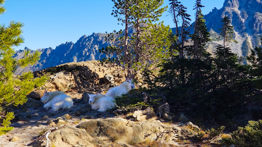
The heart of the appeal is the larches are unusual among conifers because they are deciduous, meaning that they drop their needles in the fall. The fine grass-green needles grow in big bunches of 20-30 or more, emerging from pegs attached to the twig, and these needles turn a vibrant golden yellow in the fall, for only a few weeks before they drop. This creates a visual symphony that draws hikers in droves, just to be among them, gazing in awe at the stands of golden trees set against the rugged forms of high mountain peaks. And, by itself, that would be enough, but wait, there’s more. Another delightful visual opportunity for hikers seeking subalpine larches is that mountain goats live everywhere that subalpine larches do. Their snow-white forms wander about as they seek browse, water, and rocky ridge crests to simply stand silhouetted against the sky looking truly regal. And that magic combination of golden larches and meandering mountain goats is what compels us to come, year after year, like moths to a flame.

I looked forward to our time with the trees and goats, feeling giddy with anticipation, like a kid again, going on a field trip, a most sensational field trip. Only this time, we were in charge. Fortunately, we got lucky and found a window of time, and weather, in a place where we would experience little of the health-threatening wildfire smoke that has become all too common in the dry season of recent years. We decided that a day hike, like so many of our previous trips, just wouldn’t cut it. To immerse ourselves in the magic we’d need to camp out and drink red wine as the sun set over the rocky ridges. So, we packed our overnight gear and went. Here is our story.

The Trip Report (as posted on Washington Trails): October 13-14, 2022

Why do we come? The varied alpine terrain, the stunning views of Mt. Stuart, the sapphire waters of Lake Ingalls, the radiant colors of the subalpine larches in fall, and sightings of the mystifying and magnificent mountain goats? Yes, all that, and more! There’s a lot to say about this hike so, I’ll break it down.

The Road: After departing the paved Teanaway Road there are 10 miles of dirt and gravel forest road, the first half known more for the constant washboards, and the second half for the potholes. It’s narrow in places but often has room to allow an oncoming vehicle to pass. And, there are no terrifying, exposed sections. Right now, the road is in as good a shape as I have ever experienced. Any vehicle can do it. Do watch out for meandering cows and wild turkeys (I’m not kidding).

Trailhead Parking: There’s room for about 25 vehicles, but the lot fills up fast in the peak season (larch season), even mid-week. We left my house in Newcastle on Thursday at 5:45 am and arrived at 8:00 am to find the last spot in the trailhead lot. The temperature was a chilly 40 degrees. As we finalized our packing, more cars showed up, turned around, and retreated to park on the west side of the road. On our return the next day there were some spaces in the lot, due to departures, but about 200 cars had parked along the road, leaving a narrow, one-lane space to drive out. Fortunately, we met no late arrivals. Someone would have to back up.

The Larches: Since this is the big draw at this time of year, supposedly prime time, here’s what we experienced. Because of the persistent, unseasonal heat, this October many of the larches in Headlight Basin have suffered. As I wandered among them and touched them, I felt sorry for them. While some show the more robust golden colors that we expect in this season, many (at least half) have needles that appear thin and dried out. And, many have already dropped their needles. The dusty trail and languid meadow pools of Headlight Creek are littered with fallen needles. I’d say we are now just past prime time. And, even with their fading glory, the gnarly structure of many of the trees is still breathtaking. The experience of being there is simply sensational, and the jpeg processing in today’s cell phone cameras will add color saturation to your larch photos, making them appear a bit more brilliant than they are in person, under a bright mid-day sun. Verdict? Just go, but temper your expectations of the larches. And recognize that there are many other compelling reasons to visit this area.

The Goats: The goats are always mysterious, at times somewhat intrusive, and at other times quite elusive. You never know about goat encounters. Fortunately, we saw several, both singles, and in groups with young ones, as we hiked through Headlight Basin. A couple passed through our camp later that day, on their way to water in Headlight Creek. And we saw several more, some up close, and others on distant ridge crests, viewed from Lake Ingalls, their silhouettes against the sky appearing timeless and magnificent. All were dazzling white and looked robustly healthy with full fur. Perhaps they, more than the golden larches, suspend us in the pages of a fantasy world, playing the role of mythical unicorns in the Alpine Lakes Wilderness.

Water Sources: I recommend starting with an ample water supply to stay hydrated on the trail as this hike can get hot. While in the earlier season there is often water flowing down the upper trail, a stream bed, before Ingalls Pass, now it is merely muddy in sections. The first significant water source in the dry season is Headlight Creek, which is about 4 miles and 2,300 feet of elevation gain from the trailhead. The waterfall you might expect at the head of the creek is mostly gone. What remains is a trickle of water feeding the meadow and cliffside pools, which are still a viable source to refill filter bottles. The other source is the lake, but the shallow areas are silty which complicates things.

The Weather: A 40-degree start in the shade of the morning was bracing, but the skies were clear blue, cloudless, and smoke-free. We soon warmed up and shed a layer, still in the trees and the shade. We were grateful for the cool temperatures of the morning as the trail continually gains elevation. We carried overnight gear and felt like a couple of donkeys trudging relentlessly up. As we reached the exposed sections, we hit the morning sun and a significant temperature differential. From there on we were in full sun. By the time we reached the far side of Headlight Basin, it was hot. I wished for some clouds to provide visual structure for the views, but there were none. Fortunately, there was no wind. It was quite warm at camp until the sun disappeared over the western ridge and the temperature plummeted. As chilly as we were, we were delighted that it was not as cold as we had expected. Our water did not freeze. There were only a few light breezes moving through, otherwise, the night was dead calm. At 4:00 am the sky was cloudless as the Big Dipper hovered over the western shoulder of Mt. Stuart. The scene was pure magic as the waning Gibbous Moon bathed the mountains with an ethereal light. By 5:00 am wispy clouds were streaming across the night sky, but the stars still showed brightly. We woke at 7:00 am to a brilliantly sunny day, which heated up quickly. A warm, clear day without wind made our side trips to Lake Ingalls quite pleasant, but the hike out was quite toasty, and the last miles were somewhat tedious.

Air Quality: We experienced little wildfire smoke as the skies were mostly clear. We did note what looked like smoke to the east, down in the valleys, during the sunrise on Friday. We used several online wildfire maps to plan our trip, and photos from WTA trip reports from Monday and Tuesday showed clear skies. Those sources confirmed our decision to make the trip.

The Trail: At this time of year the keyword is dusty. The trail starts in a sparely wooded forest which provides an open, expansive feeling with views of nearby Esmeralda Peak. The forest floor is host to wild grasses with amazing colors. Though I have seen deer in this section, I saw none on this trip. This section is powdered dirt with rocks and roots. Breaking out into the long traverses one encounters a narrow, sometimes sloping, and sluffing trail with exposure to loose rock slopes. Now, it’s mostly dust and rocks under the full sun. Approaching the pass, switchbacks resume and the trail becomes steeper and rockier, and at one point an ascent up a wet streambed. At the pass, one is confronted with a choice, take the main trail 1390.1 (the more obvious trail) or the alternate trail 1390.2. The main trail arcs across a talus field that provides expansive views toward Mt. Stuart and to the stands of larches below. After the talus, the trail meanders through a stand of larches and other conifers, eventually crossing Headlight Creek and continuing back into a boulder field and a rocky trail that traverses to the scramble up to the lake. The 1390.1 trail travels a longer distance to the lake but with less elevation loss. 1390.2 drops quickly from the pass and travels through the stands of trees below Headlight Basin. The two trails meet up before the traverse to the final scramble. The scramble has several variations, all of which work. The route from the creek to the lake is mostly a well-defined trail but with a few route-finding challenges. If you’re hiking through huge boulders, you have missed a connection and are likely too low. If in doubt, it may be helpful to walk to a rocky viewpoint before the creek to look across for the trail, which is clearly visible.

Overnight Camping: We took the main trail, 1390.1, through the talus field and down into Headlight Basin where we found a nice site near Headlight Creek and the trail to the outdoor toilet. There were several (four to five) good options to choose from and most could accommodate two backpacking tents. I was both surprised and gratified as I had hiked this trail six times in recent years and this was my first overnight since my twenties when we camped at the lake, in a time before the current restrictions. This time we pitched our tents on a rocky shoulder overlooking Mt. Stuart and settled in to savor the beauty of the wild place. There are also more campsites along the alternate trail 1390.2. The benefit of hauling our overnight gear up to camp was the freedom to take more time to explore and experience the first day elapsing into the next, and the opportunity to watch the sunset, the starry night, and the next day’s sunrise.

This hike is sensational because it features both Lake Ingalls and Headlight Basin, which I think is the best part. The varied terrain, subalpine larches and conifers, mountain goats, and soaring birds of prey all contribute to a deep experience of visual texture, both in the long views and a close inspection of the microenvironment.

I took six virtual reality spherical panoramic photos of Mt. Stuart, four from our camp in Headlight Basin during the afternoon, the sunset, the starry night sky, and the sunrise. They are variations on a theme and provide a cool immersive experience of the environment, so check them out. We then hiked from our camp to Lake Ingalls and I took two more. You can view each in a pano viewer at my portfolio at 360cities.net. Be sure to click the full-screen icon as you roll over the upper right of the photo for the best viewing.

Afternoon with Mt. Stuart, Alpine Lakes Wilderness, WA State: https://www.360cities.net/image/afternoon-with-mt-stuart-alpine-lakes-wilderness-wa-state

Sunset on Mt. Stuart, Alpine Lakes Wilderness, WA State: https://www.360cities.net/image/sunset-on-mt-stuart-alpine-lakes-wilderness-wa-state

Moonlight over Mt. Stuart, Alpine Lakes Wilderness, WA State: https://www.360cities.net/image/moonlight-over-mt-stuart-alpine-lakes-wilderness-wa-state

Sunrise with Mt. Stuart, Alpine Lakes Wilderness, WA State: https://www.360cities.net/image/sunrise-with-mt-stuart-alpine-lakes-wilderness-wa-state

Mt. Stuart from Ingalls Lake, Alpine Lakes Wilderness, WA State: https://www.360cities.net/image/mt-stuart-from-ingalls-lake-alpine-lakes-wilderness-wa-state

Ingalls Peak from Ingalls Lake, Alpine Lakes Wilderness, WA State: https://www.360cities.net/image/ingalls-peak-from-ingalls-lake-alpine-lakes-wilderness-wa-state


Thursday, September 29, 2022

Outer Space


I first met him through a chance encounter in the Seattle climbing community, and we soon became friends and started climbing together. It was fortuitous as we shared some spectacular routes. And one of our finest moments was on a wall that was all about granite jam cracks and chicken heads, the stark yet inviting Snow Creek Wall. I’d been looking forward to it. First climbed by the inimitable Fred Beckey in 1960, now only seventeen years later, we would ascend the elegant route known as Outer Space.

Outer ‘fucking’ Space! I could hardly wait. I hoped that I was ready, feeling a mix of both confidence and doubt as we hiked up the trail to access the wall and the base of the climb. I had done my homework, practicing my hand and foot jamming techniques, repeatedly cranking up Classic Crack, the well-known one-pitch practice route on Eight Mile Rock. When practicing climbing routes, we sometimes climbed top-roped, so we could focus on the technique involved in getting up the route, and not have to bother with the fiddling and fatigue experienced in the process of placing protection. That’s how we climbed Classic Crack.

Classic Crack was good training because it was difficult. It angled off the ground before getting vertical and made you work hard for every bit of its length. It was named as such because it was a classic jam crack. And once you felt reasonably confident and comfortable in it, you could expect that you were ready for the longer multi-pitch routes that would require the technique of jamming.

Jamming might be better explained as a wedging technique. You would wedge your hand into a crack and expand it by twisting and or otherwise manipulating it in the crack to make it larger and exert pressure on the sidewalls of the crack. The goal was to provide enough friction resistance that your hand could hold your body weight without pulling out. Foot jambs were similar, often achieved with a twisting technique. Foot jams and hand jambs were often used simultaneously. I had trained hard and thought I was ready, and I tried to stay with that thought for our attempt on Outer Space. Of course, any leads on Outer Space would require protection.

The Outer Space route is a six-pitch technical rock climb that finishes with three very exposed pitches up a solitary crack that runs up the steep shield-like face of the wall. For all practical purposes, it is a vertical ascent. The narrow hand crack, while not uniform, could be protected with either pins or nuts. Since we had officially entered the era of clean climbing, few pitons were used anymore, and we carried only racks of Chouinard Equipment stoppers and hexagonals, known simply as hexes.

In the early seventies, Yvon Chouinard, who had been making the best chrome-molybdenum steel pitons in the world, recognized that repeated use of pitons was badly disfiguring the rock on the popular climbing routes. He decided to create a better solution.

British climbers had been experimenting with machine nuts, the kind you screw onto a bolt. They threaded single nuts on nylon slings, which they would place into a crack to protect from falls. The process was to wedge the nut into a downward tapering crack, a place of convergence, and clip your rope to the sling with a carabiner, and resume climbing. Basically, if you inserted the nut correctly, you couldn’t pull it out by pulling down on it, but it was also easy to retrieve by pulling up, and, best of all, it didn’t disfigure the rock.

Yvon and his partner Tom Frost took the concept to the next step by developing their innovative stoppers and hexes, machine-tooled aluminum nuts designed specifically for climbing protection. They introduced the new concept, which they named ‘clean climbing,’ in their 1972 Chouinard catalog with an article titled, “The Whole Natural Art of Protection.”

And in that catalog, they offered their new stoppers and hexes for sale, effectively competing with themselves and killing their forged iron piton business, but creating a whole new business segment in the process and advancing the art of climbing. The ethos of clean climbing was groundbreaking. Climbers everywhere recognized it. And the techniques and tools were rapidly adopted by the climbing community.

It was with those new tools that we approached the base of the wall. We hiked two miles up the Snow Creek trail, crossed the creek on a weathered footlog, and climbed a few hundred feet up loose terrain to the base of the climb. We were warmed up and ready. We uncoiled our rope, sorted our gear, put on our rock shoes, taped up our hands, and prepared to go. 

The plan was to swing leads, with Rainer taking the first pitch. I would follow, cleaning the pitch and continue past his belay. I would lead the second pitch to its conclusion and anchor in and belay Rainer up. And so, we climbed. Rainer led the third pitch, which held the 5.9 crux, the one most difficult move of the climb, and he finished it off in style and continued to the end of the pitch to set up his belay. I soon joined him and was ready to lead the fourth pitch.

I also wanted to lead pitches five and six. I asked Rainer if he’d be okay with that. I felt a surge of satisfied joy when he said yes. The last three rock pitches all rated 5.8, ascending a singular crack that ran mostly straight up. The granite was excellent, and those leads required the jamming technique that I had so assiduously practiced at Eight Mile Rock. I set off purposefully, placing my taped hands ceremoniously into the crack. I took a deep breath and inserted the toe of one EB-clad foot into the crack, and began moving systematically, rhythmically up.

The climbing was magnificent, with beautiful, solid, clean, crystalline granite, dizzying exposure, and sensational views up, down, and around the immediate area. My hands and feet began to hurt from time to time with the action of wedging and twisting, especially the toe jams. The route had another feature, one that many climbers would use. The wall hosted curious rock formations called chicken heads, protruding granite nubbins of various sizes, some just the right size and distance from the crack to either grab with your hand or stand on with your toes.

Since they were readily available, I used them from time to time when my toes were yelling at me to get out of the crack and give them a break. And when I wanted to pause and place protection. They were a gift. I sometimes felt like I was cheating when I’d use one as a small step. The crack was just the right width for my hand and toe jamming, and with the chicken heads conveniently nearby, those pitches, even though of continuous difficulty, were a sheer delight. And I was so thankful to lead them.

As I climbed the last pitch, I slowed down a bit, not from fatigue but more as a conscious decision to more fully enter the present moment, to more deeply savor the exquisite route. I paused for a brief time in what I like to think was a Zen moment, my Zen moment, just being there, and after pausing in that vertical meditation, resumed the work of ascent.

Finally, topping out and setting up the final belay, I was overcome with the exhilaration of the accomplishment, and at the same time, the disappointment that it was now over. As I belayed Rainer up the final pitch, I recognized another climber emerging from the top of a nearby route.

It was Clark Gerhardt, one of three owners of the Swallow’s Nest, and a renowned climber himself. He had just completed Galaxy, the route next door. We greeted each other. Cool. Rainier finished the last pitch, and we packed our gear, coiled our rope, and then made our way down the grassy ledges into the brushy gully and finally back to the base of the wall and down to the creek crossing and the trail. As we descended, our conversation was rich with talk about the magnificence of the climb.

This is an excerpt from ‘We Could be Heroes,’ a chapter about several mountaineering adventures with Rainer Burgdorfer. These stories are told in my mountain memoir, Banquet of the Infinite, which is available as an illustrated eBook on Amazon, Barnes & Noble, and Kobo.

I was later to regret that I have no photos of Outer Space as I was too busy with the task at hand, pun intended. It was just too vertical. We were continuously focused and active. And truth be known, I routinely climbed without a camera on some of the more challenging routes by choice, not wanting to have one more job, that of documenting the climb. The photo of me practicing in Classic Crack was probably taken by Jeanette Grabos.

Monday, August 29, 2022

Trappers Peak

After last week’s ignominious defeat on our attempt to summit Luna Peak (we didn’t even get close), we had to come back. If we couldn’t gaze in wonderment at the spiky spires of the Southern Pickets from the north side, perhaps we could view them from the south side. Our solution, summit Trappers Peak and look north. Visions of granite peaks enveloped us as we planned to not only see the Southern Pickets, but also Mt. Triumph and Mt. Despair, and the three Thornton Lakes, all tiered in ascending rocky alpine bowls.

The trailhead to Trappers is a long drive from the Seattle area for a day hike. I have done it before but didn’t look forward to that solution. Perhaps we could camp at Thornton Lakes and summit on day two? We couldn’t get a Thornton camp permit which led to a better solution. We scored the single remaining available reservation for a walk-in camp at Newhalem Campground. It was perfect! Easy car camping and Thornton Lake Road was only minutes away. And we wouldn’t have to haul our heavy overnight packs up and down to Thornton Lake. Why didn’t we think of that before?


We settled in at the campsite picnic table and carbo-loaded with spaghetti with meatballs and a tasty Argentine Malbec. And, wonder of wonders, very few bugs! After dinner, we pulled out various maps and planned future trips. Our mood was auspicious. The route tomorrow would require no bushwhacking. We slept that night with summit dreams. Arising at 6:00 am we planned to be at the trailhead by 7:30 am. Reality? Closer to 8:00 am. The graveled road to the trailhead is exactly five miles and is steep and furrowed with washboards and potholes. I figured 15 to 20 minutes. It took closer to 24 minutes because we didn’t want to wreck the car. I recommend high-clearance AWD. To provide some perspective, the elevation at the campground was 650 ft. The elevation at the trailhead was 2,641 ft. (as measured by my Suunto sport watch). That is a fair amount of gain in 5 miles. The trailhead parking lot is small with a capacity of 10 to 12 cars, not counting road parking. We were the sixth car.

The air was cool and the hike along the decommissioned road was often a single trail. We crossed several good water sources, two in succession just past the one-mile point, the second having a classic single log bridge with a handrail. While some may describe this section as flat, it gains about 550 feet in the 2.2 miles before the end of the road. Then the trail gets down to business, ascending about 1,850 feet in the roughly 2.35 additional miles to the trail split post for Thornton Lake and Trappers Peak. Just looking at the stats does not adequately convey the difficulty. The woodland terrain is a veritable rock and root fest. The kind of trail where you spend a lot of time looking down, both ascending and descending. 

There is another picturesque creek crossing at about 3.75 miles, just prior to the National Park signpost, and an opportunity to filter more water as the trail up Trappers soon emerges into full sun and can get hot. You’ll want to stay hydrated. Another signpost announces the trail split to either Trappers Peak or Thornton Lake (the lower of the three) at 4.55 miles and 5,050 ft. elevation.

Ascending Trappers takes another roughly .8 mile from that signpost and 900 plus feet of additional elevation gain (according to my Suunto sport watch). Some of it on an easy-to-follow trail and intermittent sections with steep scrambling. The crux scrambling section comes at about 5,350 ft. The steep rock pitches upward against a granite wall on the left. The route narrows into a chimney-like formation. Fortunately, there are several sturdy tree limbs on the right, available to grab onto. Once past the crux, there are still a couple of steep sections and some exposure. One is a short traverse along a narrow granite rib with exposure on both sides. It’s easily doable as long as you’re paying attention. For those of us without exceptional abilities, it simply means that we’ll be taking it a bit slower. The route is actually easier to follow on the way down, as is the descent of the crux chimney section.

So, what about the summit? Once arriving at the top, it was an exhilarating surprise to see such a magnificent panorama of spiky peaks surrounding Trappers. Think of your favorite superlatives. They all apply here. Simply jaw-droppingly beautiful! And, the summit is spacious, with room to roam. As I set up my tripod to shoot frames for my planned spherical panoramas, I noticed the weather was changing. I wanted some clouds for visual structure but there were far more than I had envisioned, the sun at moments peeking through and at other times obscured by the enveloping clouds. The summit peaks of the Southern Pickets were shrouded by the drifting white stuff, but the east face of Mt. Triumph jutted proudly before us. The upper Thornton Lake, ensconced in a steep granite bowl, still had ice on the surface. Completely entranced, we stayed, snacking, exploring, and photographing for an hour and a half before heading down. None of us wanted to leave.

As we descended the clouds continued to accumulate. We did not hike down to the lake on our way out. Although the summit is only 5,966 ft., the mountain views are some of the finest in the state. The hike is more physically challenging than the stats suggest (10.6 miles RT, 3,500 ft. cumulative elevation gain). Little elevation is gained in the first two-plus miles and the balance ascends with a purpose, the terrain often rough and sometimes steep and in places, exposed. That being said, it’s a very accessible summit for the experienced hiker and scrambler. We all loved it. Laissez les bon temps rouler!


Tuesday, August 23, 2022

Luna Peak Dreams

“Let’s do the Pickets.” Mark’s enthusiasm was so infectious that I replied without pause, “Luna Peak!” And, that was that. After a week of quick planning, securing an overnight permit for Luna Camp, and making Ross Lake water taxi reservations, we packed up and headed north.

Our mission was to summit Luna Peak, the highest peak in the Picket range area, to experience the dramatic views of the spiky peaks of the Northern and Southern Pickets. Instead of a quick trip, we decided to take five days. I chuckled to myself that instead of attempting an FKT, the fastest known time, we were going for an SKT, the slowest known time. We would surely be contenders.

The plan was to take the water taxi up Ross Lake to the Big Beaver Camp for drop-off at the dock. Then hike 10 miles up the Big Beaver Trail to make Luna Camp on day one (August 17th). Our day 2 goal was to backpack cross country up 1,700 feet of elevation gain to establish our Access Creek Camp in a basin near the headwaters of Access Creek. On day 3 we’d ascend 4,100 feet to the summit of Luna, with light day packs, and return to our camp for another night. On the morning of day 4, we’d descend from Access Creek Camp back to Luna Camp for the night, and hike out to the dock for water taxi pick-up on day 5. It was a good plan that parceled out the challenging journey into bite-sized chunks. It seemed easy and doable from my home in the greater Seattle area. But like so many mountain adventures in the North Cascades, the plan blew up.

We left at the crack of dawn and drove to the Marblemount Ranger Station to pick up our pre-reserved Luna Camp permit. We arrived around 8:00 am to find a host of hikers milling about, waiting for walkup permits. It was a ‘please take a number’ situation, literally. So, I took a number and waited. The time cushion from our early start was evaporating. We had a 9:45 am water taxi reservation at Ross Lake. The guy said we needed to be on time or we’d have to wait until 12:30 pm for the next opportunity.

When I got to the Marblemount Ranger Station permit desk the ranger asked if we had ice axes and helmets. We did not. The ranger frowned. GPS and/or locator beacons? No. Another frown. Bear cans or bags? Yes. A smile. Had we bushwhacked before? Why yes, we had. Another smile. Did we bring blue bags? No. Another frown. So, the ranger gave us enough for our party of four for two nights at Access Creek Camp. I assured the ranger that we had long mountaineering experience and wouldn’t do anything stupid. The process was impressively thorough but chewed up more time than I had anticipated.

On the road from Marblemount to the Ross Lake parking lot, at mile 134, we encountered three separate road crews working on repaving. Three stop-and-wait situations occurred, all with a slow drive following the lead truck through each of the one-lane sections. More time evaporating. A nail-biter. We finally got to the parking lot and found what looked like the last space. We shouldered our packs and hauled ass down the trail to the dock. The trail was actually quite beautiful but everything went by in a blur as we hustled to meet our water taxi.

We made the hike to the dock in 21 minutes, arriving at 9:41 am, with 4-minutes to spare. No water taxi at the dock. Huh? We waited. The boat showed up at 10:00 am. We loaded our packs and climbed in. With 250 horsepower, the water taxis really haul. A feeling of exuberance enveloped us all as we sped towards the Big Beaver dock. The trip to Big Beaver Camp and the start of the Big Beaver Trail took only 10 minutes. We began hiking a few minutes later.

That Wednesday and Thursday were forecast to be around 90 degrees so we wanted to make time in the morning before the day really heated up. Fortunately, the early part of the day was reasonable. The plan was to continuously hydrate and eat snacks during a single push on the 10 miles to Luna Camp. My Suunto Ambit Vertical 3 read the elevation of the lake at 1,588 ft. So, close the 1,600 ft. as advertised. As we progressed towards Luna Camp, the day grew ever hotter and the last miles to camp were absolutely brutal, even with relatively light 35 lb. packs. We perspired mightily as the bugs swirled around us. Luna Camp at 2,500 feet suggested 900 feet of gain on the hike in. However, the trail periodically gains and loses elevation so my recorded gain for the day was 1,485 ft. Luna camp read at 2,510 ft.

The trail itself has enough plant diversity to please any biologist, complete with gigantic Western Red Cedars and a good variety of fern species. At times Big Beaver Creek is in the view from the trail, and sometimes not. At one section, a few miles in, the water slows into a marshy section, complete with lily pads and horsetail growing alongside the trail. Near that section, we were astonished to witness hundreds of tiny creatures darting about on the trail. At first, I thought they we cricket-like bugs. On closer inspection, we found they were very tiny frogs, between 10 and 15 mm. They did not pause long enough for any decent photos.

There are numerous cold-water sources along the way, as feeder creeks cross the trail. They increase in number as one approaches Luna Camp. I counted six in the last two miles before the trailside Luna Camp signpost. Once there, one descends about 0.3 miles and 60 feet to two tent campsites, and a single campsite for horse campers, all spread far apart from each other. We picked one, pitched our tents, and settled in. The bugs arrived on cue and tormented us as we tried to relax and get ready to make dinner. Although hot and buggy, we were mindful of our good fortune. The bugs could have been way worse, and the air was still and without rain. The camp toilet location was well signed. A fairly new open-topped wood box looked out over a forested area thick with fallen timber, truly a room with a view. The nearby water source was a creek with a shallow pool which we also used to wash and cool our sweaty bodies.

We agreed to rise early and be on the trail to find the brushy backcountry route that leaves the Big Beaver Trail, descending to the water crossing and the intermittent climber’s trail on the north side of Access Creek which would lead us up to the open basin near the headwaters of Access Creek, an area from which we would finally see the cathedral-like silhouette of Luna Peak. That objective would be Access Creek Camp at about 4,100 ft., our base camp for our summit day. Day 2 looked like about 4 miles and 1,600 ft. of elevation difference. We expected to travel slowly as there is no established, well-signed departure route from the Big Beaver Trail, through the brush, and an obstacle course of fallen trees, to the shoreline of Big Beaver Creek. And once there we might find a friendly log to cross, or not, and have to wade. A successful crossing depended on the right log and/or a wadable section. We didn’t know, but we did regard it as the crux of the trip.

The plan was to arise at 6:00 am and be on the trail by 7:00 am. Reality? 8:20 am. We headed up the trail, somewhat confident that we’d be successful. After all, we had many years of mountaineering experience and had read all the beta that we could find from Peakbagger.com, SummitPost.com, and WTA.org. Most reports suggested heading 1.5 miles up the camp marker and then plunging into the brush (small confers, devil’s club, etc.) and a continuous thicket of fallen trees (many quite large), and making way down to the water. Then a shoreside search for a crossing would occur. Some travelers reported finding convenient logs or wading reasonable sections, while others searched for hours for a way to cross. On day 1, we met a couple of departing climbers who had successfully completed their ascent of Luna Peak. As we suspected, they confirmed the presence of negligible snow and no need for an ice axe. They suggested leaving the trail at 1.1 miles up from Luna Camp. They also mentioned a faint trail near a fallen tree. I noted later that I should have asked them to describe the fallen tree so that I might distinguish it from the hundreds of others. What could we expect to find?

Well, we went way further than 1.5 miles and yet found no indication of any trail. So, we backtracked and tried crossing through the brush at the 1.5-mile mark. It was an arduous undertaking and so distant from the creek that we turned around and went back to the Big Beaver Trail. We hiked down and tried again at 1.1 miles, without success. We headed back to a point where we could actually see the distant creek at about 0.95 miles from Luna Camp. To make an easy recon, we left our packs by the trail and made it down to the creek. A steep bluff led us to the shore and there was a crossable log and another two upstream that were higher above the water and narrower in diameter. The creek was flowing fast and deep enough in this section to negate wading. Now what?

We had burned up more miles and time than reasonable to get to the water. But worse, the experience had eroded our confidence. My companion said, “So, we get to the other side. Then what?” Our failure to navigate this one short section had germinated significant seeds of doubt that we’d do any better on the other side. After some consideration, we found that none of us wanted to hike back up to get our packs, hike back down through the brush, cross the log and hike into more brush and get completely fouled up, and lost. I had a map and compass, but there wasn’t a GPS among us, so, we were a bit light on precision tools for navigating the brush with any confidence. Since there was no universal agreement to proceed, we bagged it.

Were we disappointed? Yes! And, we were completely dumbfounded that we hadn’t easily found the right path and crossed the creek. That had never happened to us before. What the F? We settled in back at camp and had dinner with the mosquitos and black flies. At least we had plenty of wine. We grumbled about the day as we ate, yet we looked forward. Always resilient, we conjured up a consolation plan. We’d hike out, catch a water taxi, and head to the Thornton Lakes Trailhead, hike in, and summit Trappers Peak. We so needed to seize some victory from the jaws of defeat. Yes, that would help us feel better. Absolutely!

The next day we hiked out, just missing a drop-off water taxi by 20 minutes. Later, some friendly campers who had rental boats heard our story and suggested that since they were headed to the resort for Wi-Fi, they’d tell them we needed a water taxi. It was a gift to have them do that as we had no way to communicate with the resort. After waiting for 3 hrs., the taxi finally showed up at 4:00 pm and we sped back, a light rain splattering on the windshield. After 10 miles on the Big Beaver Trail, we were not looking forward to that last uphill mile from the dock to the parking lot. We trudged up, loaded the car, and drove away to search the nearby campgrounds for an overnight tent camp. All were full. It was Friday after all. Nuts! We returned to the Seattle area, after a burger stop in Darrington, and resolved to come back, not for Luna Peak, but to summit Trapper’s, for its unique and sensational views of the Southern Pickets.

Dreams and defeat, the never-ending story of so many mountain adventures. Visions of Picket views from Luna Peak were torn to bits during our cross-country bushwhack. The seemingly impenetrable traverse through thick brush, devil’s club, and fallen trees strewn like matchsticks, thwarted our attempt to successfully navigate the route beyond the Big Beaver Creek. Add baking heat, dive bombing mosquitos, and biting black flies. Type 2 Fun. Ha, ha, ha! Another character-building event. We loved it!

Postscript: The physical suffering on this trip was relatively minor, as it could have been way worse. And, no one got hurt. What stung was our humiliation (we’re better than this) and frustration (the impedance of a goal seeking motive). However, the best cure for a compromised mission is that glorious vision of the next.


Sunday, July 17, 2022

The Rat Creek Affair


Rainer and I woke early to get a jump start on what we knew would be a long day. Our next outing was not to be a technical climb, but more of a cross-country enduro event. We slept in my old Ford Econoline panel van at the trailhead parking lot not far up the Icicle Creek Road. It wasn’t your classic, middle-of-the-night alpine start, but it was good enough.

Packing light with summit packs, wind shells, gaiters, water bottles, some food, and our ice axes, we headed up the trail on a crisp spring morning wearing mountain boots, shorts, and t-shirts. It was pretty chilly early in the day, but it would warm up to be searingly hot. I had hiked up the Snow Lakes trail before, laden with a heavy pack filled with overnight gear and food and fuel enough for a few days of camping and exploring the fabled Enchantment Lakes.

Our traverse was back in the days before the current permit system, and we came on a schedule that we determined, driven by a recent weather forecast and a whim, not by a lottery date. We camped at our discretion and never saw another person while we were up there. That may be hard to believe now, but then we had it all to ourselves.

What is currently known as the Core Zone, which is the heart of the Enchantment Lakes Basin, is an expansive environment, and so it would be easy not to see any other parties even if they were up there. Backpackers came to camp and explore the Enchantment Lakes, taking several days to do so. Unlike today, few, if any, hikers would traverse the basin in a day.

It seemed like a perverse, outrageous, crazy idea when I conceived it and called on Rainer to join me in doing it. It would be about 20 miles with well over 6,000 feet of cumulative elevation gain. He readily agreed to my ‘Enchantments in a Day’ concept. We did not think that anyone had yet done it. That and the physical challenge were a big part of the appeal. Someone may have traversed the Enchantments, but that sure wasn’t obvious. No published record existed, anywhere. On these kinds of fringe exploits, you never really knew. And it didn’t matter. You just went out and did them.

We practically flew up the trail past Nada and Snow Lakes with our flyweight packs. It was a heady feeling as the elevation gain could be a killer with a heavy backpack. We paused briefly at the lakes along the way to slake our thirst as the day grew hotter. We were on a mission. Once in the zone, we kept constantly moving, passing Lake Viviane, Leprechaun and Perfection on the way to Prusik Pass.

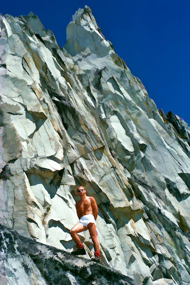
We each paused before the dramatic spire of Prusik Peak for the obligatory hero shot, Rainer’s bare-chested visage looking far more heroic than mine. We lingered at the pass, took a quick look back, and then, ice axes in hand, plunge stepped down a steep snowfield towards Shield Lake. Both exuberant and pumped, the day had been unfurling before us, as amazing as we had imagined it would be.

The feeling would not last. The next section of our route was not routinely traveled. There was no trail. That had ended at the pass. Our traverse had been very enjoyable up to the snowfield descent from Prusik Pass, but once we reached the Rat Creek drainage, it all went straight to hell.

The section down Rat Creek back to Icicle Creek Road was surprisingly torturous. We ended up bushwhacking out and down through the drainage, up and over boulders, in and out of the water, and through thickets of slide alder and Devil’s Club. Also known as the devil’s walking stick, its erect and woody stems have despicable, needle-sharp spines. Their scientific name seems apt, Oplopanax horridus. The noxious plants were impossible to avoid and the profuse woody spines stung like hell. That part of the route was a form of self-imposed torture, which made it epic, which was about the only good thing you could say about it. Epic was cool. But the price you had to pay often was not.

Once Rat Creek finally entered Icicle Creek, we made an improvised crossing and clambered back up to the dirt road. The overall miles covered, the accumulated elevation gain and the final bushwhack had taken us to our physical limits. We were both thrashed. We stumbled down the road in those final miles, our feet hurt, and we were famished. It was remarkable that we had not lost our sense of humor. But that last bushwhack had been so ridiculously stupid that we had to laugh about it.

That descent from Prusik Pass sure seemed like a good idea at the time. It was a considered decision as the route down Aasgard Pass and exit via the Stuart Lake Trail would have been impossibly long when combined with a walk from that trailhead back down the roads to my van. It was a variant of an Enchantments traverse that was yet to come.

These days Enchantment day-trippers make a 20-mile traverse from one trailhead to another by having either two vehicles or a shuttle for the drive between trailheads. The recent popularity of today’s traverse is, of course, driven by the extreme difficulty of getting an overnight permit. If it were easy to get an overnight permit, few would opt for the arduous traverse.

For us, back in the ’70s, it was just an inspiration that had nothing to do with permits, as there were none. We had neither a second vehicle nor a shuttle and planned to walk from our exit point at the end of Rat Creek down the road a few miles and back to the initial trailhead parking lot and my van.

At least the whole adventure would make a good story over beers, a story that would endure well into the future, and it was our epic story. And we would soon be engaged in the telling of it for our friends. It was that good. And if you, the reader, think this sounds interesting and that it might be a fun alternative route instead of today’s usual Stuart Lake trailhead to Snow Lake trailhead route (or the reverse direction), I have some advice for you.

“Don’t even think about it!”

This is an excerpt from a chapter titled ‘We Could Be Heroes,’ a mountaineering adventure story about our one-day Enchantment traverse and two other exploits. The story is told in my mountain memoir, Banquet of the Infinite, which is available as an illustrated eBook on Amazon, Barnes & Noble, and Kobo.

Tuesday, July 5, 2022

The Pursuit and Purpose of Practice


We’ve all heard it. “Practice makes perfect.” Wait a minute. Not so fast. The rejoinder from the ‘smugsters’ who ‘know it all’ is always, “Perfect practice makes perfect.” But, is practice really about the pursuit of perfection? I submit not. Perfection is an elusive goal, rarely if ever attained. What is perfect? And does it really matter?

Perhaps practice should be engaged in for its own sake. Even with imperfect practice, the kind we are all capable of, we learn something. We learn both in the moment and in reflection later. In practice, we train our minds, our perceptions, and our motor skills. And, even with imperfect practice, we are very likely to improve, even without conscious effort. In fact, it’s difficult not to improve. The inexorable path towards improvement seems to be an incontrovertible part of the inner human imperative, conscious or not.

Having recently resumed sketching and watercolors, I often compare the activity of art to running and other sports. Reluctance and drive struggle before the medium is confronted with purpose. It was the same way with my running. The hardest step was always that first step out the door. And so, it is the same with the pursuit of artistic practice. But once the medium is engaged, the pencil touches paper, and the brush applies pigment, all resistance and hesitation fall away. It is as if we are wading into a moving stream. Your journey enters the present moment.

To move forward, it’s best to engage in a discipline of regular practice, whether we feel inspired or not. When stuck, without apparent inspiration, it’s often useful to follow the examples of others. As young architecture students, we received many consecutive semesters of instruction in the fine arts. We practiced with studio subjects and often copied the sketches and paintings of the masters, who previously copied the masters before them. When not in the studio, we sketched from life, en plein air. Five sketches a day, minimum. It often seemed a tedious requirement, but once engaged we achieved flow.

And now, after so many years as a working professional, an executive, in the years without art, I find it so satisfying to return. With creative tools in hand, the only person I have to manage is myself. I am accountable to no one else. The choice to practice is always before me and I find it best to engage my sense of purpose, visualize what I want to achieve, and simply start. After all, the hardest part is simply getting started.

I recently checked out a copy of ‘Watercolor in Nature’ by Rosalie Haizlett, a young artist from West Virginia. The subtitle intrigued me, ‘Paint Woodland Wildlife and Botanicals With 20 Beginner-friendly Projects.’ I picked 17 of the 20 exercises and began by sketching the subjects in pencil and then painting in this 7x10 wire-bound watercolor pad. I resolutely followed Rosalie’s meticulous approach which relies on a wet-on-dry technique. I found her exercises both challenging and fun. And while I struggled to emulate her examples, I learned a lot and was quite pleased with my results. I wholeheartedly recommend her book. It's certainly one good way to practice. And, as one artist said, "Practice makes progress."


Put a Mailbox on It

When I started up the trail at 7:30 am, I was alone. There were no other cars in the spacious trailhead lot. In the cool of the morning, I s...

Beers in the Stream