Monday, January 1, 2024

The Last Ice Axe

It hit me with a wallop. Stunned, I barely held back my tears. It had once been so robust and magnificent, a vast field of ice. Now only a fractured patch. An emotional despondence overtook and overwhelmed me in that moment. I had come so far to gaze upon it once more, and most of it was now gone, probably forever.

The steep climber’s trail took me to Horseshoe Lake, a liquid sapphire in a high alpine bowl. I wanted to regard the north side of Mt. Stuart, a mountain I had climbed by three different routes in my youth. The classic North Ridge had been my first, and I wished to see it again. Not easily visible from Lake Stuart, the much higher and closer lake would provide a stunning view. And later, perhaps the opportunity to hike nearer, climb onto the Stuart Glacier, and photograph the stunning granite buttress.

I imagined myself high on the ice, setting my tripod beneath the towering flank of the fabled North Ridge, and looking up the steep and slender Stuart Glacier Couloir, recalling my climbs from so long ago. I yearned to bask in the remembrance of those glorious exploits as I readied my camera to make several spherical panoramas. Sadly, it was not to be. My plight was to stand back in shock and absorb a tragic loss. Not an inexplicable loss, because I knew the reasons why, the irrefutable ravages of human-caused climate change. It shook me nonetheless. Yet, I felt a surge of denial in the face of the reality in front of me. It seems that we will not easily accept that for which we are not yet emotionally prepared.


I remained on my rocky perch regarding the glacier. It looked so sad, so forlorn, I could not approach it. Remembering the day that I had once traversed the vast glacier from Goat Pass to the North Ridge, I sighed. Ice axes in hand, we four quickly crossed the sun-cupped surface unroped, always mindful of potential rockfall from above and the gaping crevasses below. It was as if we had entered the gates of an alpine cathedral, the day bright and shiny, with the promise of a crystalline granite ascent and a magnificent summit ahead. That spectacular day was now only a memory, never to be repeated.
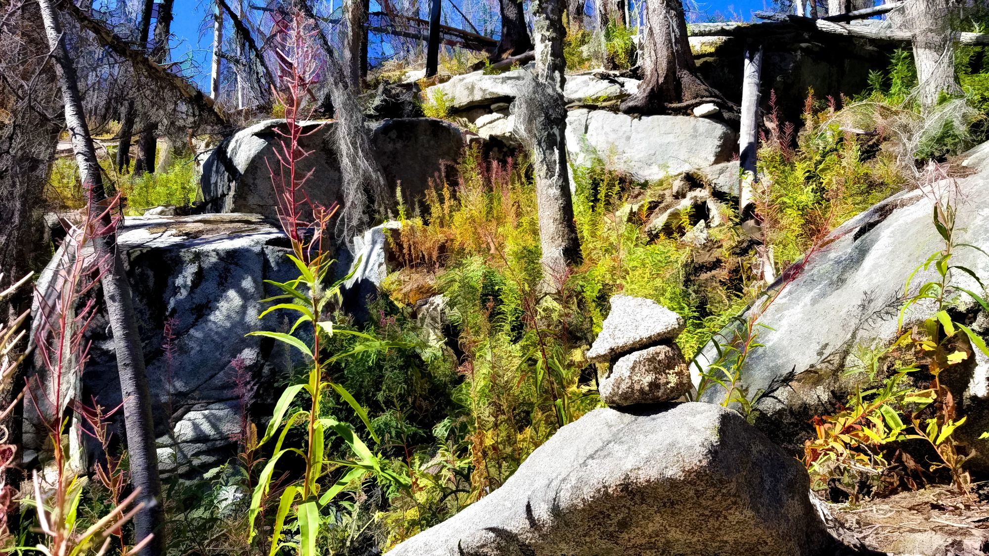
Just a few weeks earlier, I had hiked to the Source Lake overlook to see The Tooth, my first multi-pitch alpine rock climb. I expected to ascend to Pineapple Pass, the base of the South Face route. Visualizing a photographic composition from that site, in my mind already stunning, I continued. The narrow trail abruptly ended in a steep talus field high above the lake. The balance of the route would be up and across a daunting expanse of sharp, loose rock. Only rock. No snow. Hardly inviting, certainly time-consuming, and surely not much fun.

Where was the vast snowfield that we had ascended in 1974? My thoughts drifted to the past.

When Nicolai first invited me to climb The Tooth he added,

“Bring an ice axe.”

I responded in the affirmative, not letting him know that I had no ice axe. That would be lame, I thought, to straightaway admit that. At the first opportunity, I hurried down to the REI on Capitol Hill and perused their selection of ice axes, all freely hanging on a wall. No one helped me, and perhaps I did not want to be assisted and thus reveal myself as a lowly novice.

I picked up a nice-looking axe, which was my primary criterion, not knowing anything. It had a sleek lacquered hickory shaft with a polished steel head sporting a sharp adze and a slightly curved pick. A pointed steel spike at the other end completed the package. The pick blade was stamped ‘CAMP Made in Italy.’ Looks good, I thought. I swung it a bit. It felt good. But what did I know? And then, the decision made, I headed to the cash register. The feeling in that moment was somewhat euphoric. I had my first ice axe. It was a beauty, and I was on my way.

We headed up the Snow Lake trail from the Alpental parking lot and passed into a truly alpine environment. A brilliant sunny day spoke of possibilities. We left the hiking trail and, after passing Source Lake, encountered snow.

Nicolai pulled his ice axe from his pack, and I did the same. He began ascending the steep snow slope, kicking steps, and plunging the spike into the snow. I watched and, a bit unsure of myself quickly called out.

“Hey, how do you use this thing?”

The cat was now out of the bag. I did not know shit about travel on snow or ice.

Nicolai did not give me the business about it or laugh in my face. Like a patient mentor, he explained the rudiments of ice axe use for glacier travel, demonstrating the techniques. I picked it up quickly, relieved that my little bit of instruction had gone so well, and we continued toward the base of the granite spire known as The Tooth.

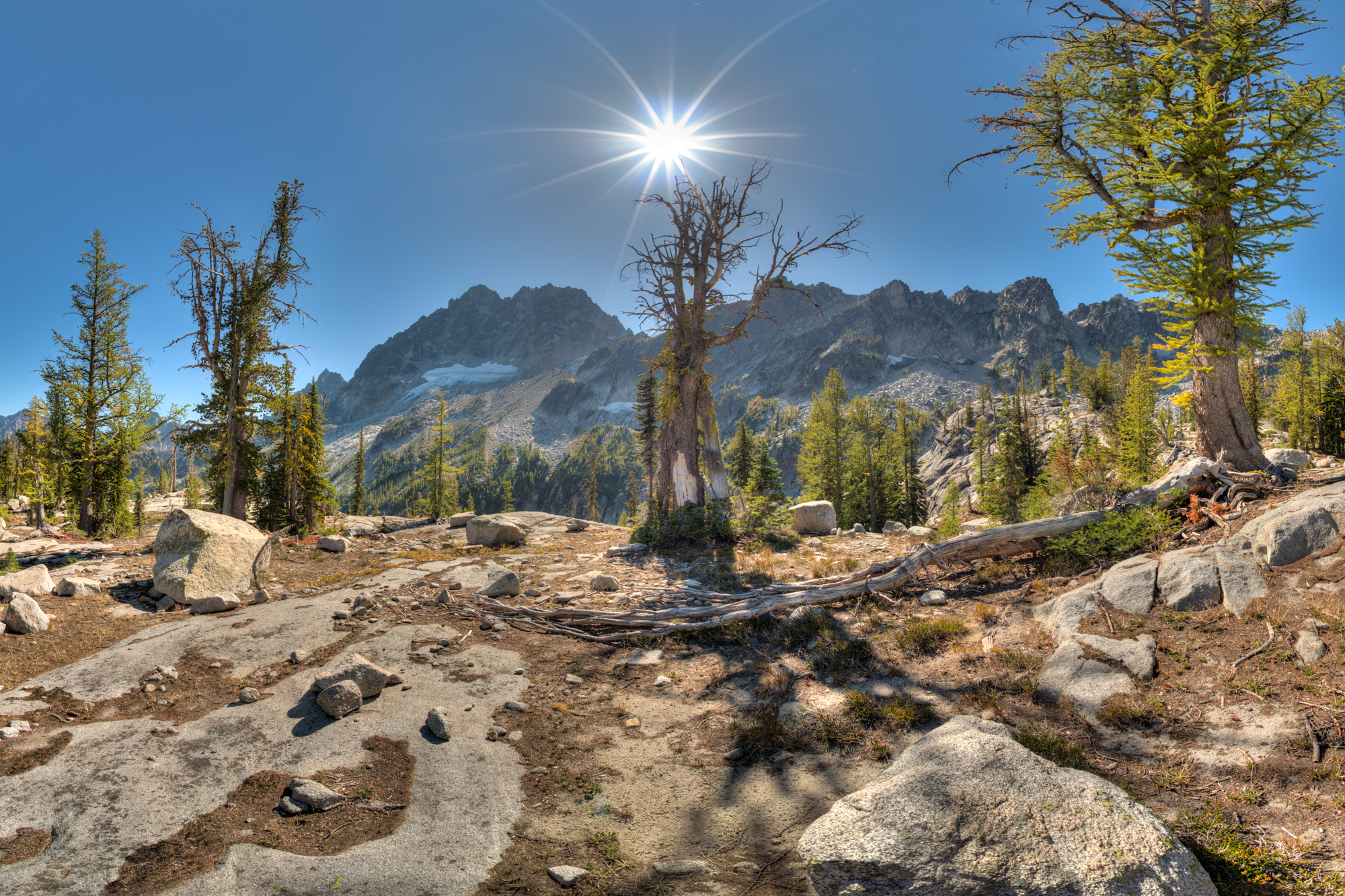
I remember that brilliant day well. The three-pitch technical climb, relatively straightforward, athletic, and satisfying, led to a descent that proved to be big fun as well. We rappelled back down the climbing route, taking it slowly, savoring both the place and the process, and were soon back on snow, the softer mushy snow of the hot afternoon. I was elated. The day had been perfect, and in a real sense, I had been spoiled. Not all alpine rock climbs would be of that quality and rarely conducted on such a fine day.

Gazing at the approach, once a vast snowfield, now only jumbled granite, I exhaled and paused. Would I climb the tortuous talus to reach Pineapple Pass today? My yearning to be there again fought with my now older self, the self that felt the photo opportunity was probably not worth the extra effort. That and an ounce of caution due to the potential for injury on a solo outing. I took some panoramas of the cirque from where I was, and once satisfied, departed. It had been a fine day even without revisiting Pineapple Pass. Perhaps sometime next season, with an enthusiastic companion, I said to myself.

Previously, Mark and I hiked up to Cascade Pass and then Sahale Arm in one of the most magnificent alpine environments in the North Cascades. Our plan, hike to the Sahale Glacier Camp, high on the shoulder of Sahale Mountain, and use that location for some dramatic mountain photography. We tent-camped at Marble Creek Campground the night before to split up the long drive from the Seattle area and get to the trailhead early. Up before dawn, we drove the rutted road to our departure point. The weather remained in transition, uncertain, but encouraging.

It reminded me of the day when Nicolai and I had embarked on the Ptarmigan Traverse so many years before. That day the ephemeral promise of fair weather rapidly evaporated at Cascade Pass, changing to pelting rain and blowing snow for our next three days of the rugged mountain traverse. We nearly froze to death.

Today would be different I thought as we hiked the first miles to the pass. The next section would be more challenging. After ascending the steep granite switchbacks, we followed the trail up the Sahale Arm’s exposed ridgeline and encountered a stiff cold wind. After the warmth of the switchbacks, the transition required layering up, and wind shells. 

Several bands of mountain goats, many with kids, passed over the trail, often nearby. One senior goat came close, regarding me, evaluating whether I was a troublemaker or not. After determining that I was no threat, the decisive leader guided the group past. We resumed hiking. I took to a prominent knoll on the arm, about three-quarters of a mile from the high camp, set up my tripod, and took several sets of photographs. The fast-moving clouds both tormented and pleased me by alternately obscuring and revealing Sahale Mountain, Mix-up Peak, The Triplets, and Johannesburg Mountain. After thirty minutes in the icy wind, my hands were freezing. Satisfied, we chose not to continue to the Sahale Glacier Camp and headed back down. The frigid wind had beaten us.

Though the Sahale Glacier appeared smaller than I had expected, I did not realize the full extent of it until I returned home. I compared my current photographs to those I took looking back from the Cache Glacier as Nicolai and I climbed toward Cache Col on our 1976 Ptarmigan Traverse. The difference was significant, staggering. And, the same was true when I examined the present state of the Cache Glacier. I knew then that my romantic desire to repeat the Ptarmigan Traverse might never be realized. And, even if I embarked on the route again, it would never be the same. The glorious ermine robes of snow that once so fully cloaked the spiky peaks would now be forever diminished.

Though I had traversed the massive South Cascades Glacier during that Ptarmigan Traverse, I had not seen it in person since. Recent photographs were my only source of information on the state of its glacial ice. In those, the retreat, the loss of glacial mass balance, was dramatic. And yet those pictures seemed somewhat abstract, only a view from a distance, captured in a photograph by someone else. While I cognitively processed the dire situation, the photographs conveyed little of the emotional impact of perceiving the loss firsthand. To return to those places I had traveled before, to see them up close, my eyes immersed in the moment, the changes made real, my emotions unleashed. It felt like witnessing the death of a loved one. 

I did not think of it at the time, but looking back, I realize this mountain season was, for me, a regrettable trilogy of loss. And, of the three, the last, the Stuart Glacier was the one that truly burst the dam of my emotions. If I am honest with myself, they all broke my heart. I felt my own personal solastalgia.

Solastalgia is a new thesis that we are destined to encounter with increasing frequency. The environmental philosopher, Glenn Albrecht developed the concept to provide clarity to the psychological impact of environmentally induced stress. It is an emotive experience we feel when we encounter the negative effects of human-caused environmental change. It can range from observing and feeling the impact of strip mining to retreating glaciers, experienced as a form of distress that is exacerbated by our perception that we are powerless before the process of irreversible environmental change.

I experience it as a profound form of loss of which I am not yet capable of wrapping my emotions around. It takes time. Years ago, I spoke about loss with a friend who was a developmental psychologist. I observed that as I aged the experience of processing loss was becoming more frequent. He replied, “It becomes constant.” I absorbed his sobering statement. It resonated with truth. And, I did not minimize it.

While my earlier observation was about the loss of people we knew and often loved, it has now become even more true in the high alpine context. It now confronts me every year. I regretfully acknowledge I will not likely revisit most of the mixed alpine climbs that remain forever enshrined in my fondest memories. Those icy places are no longer the same, much smaller, shadows of their former selves, and often worse, gone forever. That disconcerting recognition and the pain of it has stayed with me and probably always will.

I later wryly mused that ice axe sales might well be plummeting given the atrocious conditions of recent years. Perhaps there would be no point in making any more of them. Curious, I sought confirmation. It seems that I was wrong. Industry reports project ramping demand for ice axes as the number of people flocking to mountain sports steadily increases. Sales certainly cannot be driven by the accumulation of ice. It is not happening. Many of the most revered ice climbs have completely disappeared from the planet, or are in the process of doing so. Okay, many steep snow and ice climbs might still be viable in a very narrow early season window of time, after consolidation, and before they rapidly melt out. You certainly will not see the same amount of north-facing ice we used to see in years past. The Stuart Glacier Couloir, once viable in summer is now nothing but rock. The Black Ice Couloir on the Grand Teton is not always filled with the ice of yore. It has melted out and reformed, many times, depending on seasonal weather. What once we took for granted, we can no longer expect. Those days now seem irrevocably lost.

These now shorter windows for peak conditions will make the steep ascents even more tricky. I recall the three unfortunate climbers who lost their lives on Colchuck Peak’s Northeast Couloir this recent February. They had come from the East Coast, were unfamiliar with the local mountains and snowpack, and had a short climbing window based not on mountain conditions but on their travel agenda. The lead climber released the avalanche as he planted his ice axe. Though the slide was relatively small, the couloir was narrow and steep, and their falls long, and traumatic. The exposed rock and choked walls were deadly that day. I submit that they ignored the unfavorable conditions as their planned ascent was driven by a self-imposed timetable, rather than what the mountain might wisely suggest.

I did not make light of their deaths. As always, I felt grief, a grief that I had experienced before, for all those who had perished, many of whom I had known. I wished their deaths were not true and that I had not heard of them. But they held a very important lesson. If you were going to stay in the game, you could not turn away from the deaths. You really needed to pay attention to those mishaps, learn from them, and take the lessons with you as you would with any piece of acquired gear or technique. You did not want those thoughts to dominate your consciousness, and you did not want to treat them blithely either, because they mattered. A lot.

Despite that cautionary knowledge, we still yearn to ascend those icy faces and couloirs. We know it will demand even more scrutiny of conditions, seasoned judgment, considerable patience, the requisite skill to succeed, and the wisdom to know when to walk away. It all seems more difficult than ever before.

As we imagine our future alpine objectives, paging through dog-eared guidebooks and online beta searches, it is all too easy to imagine we might need another ice axe. Yeah, that Colchuck Glacier sure looks inviting. Maybe a newer, shorter, lighter axe? Perhaps no other piece of mountaineering gear better symbolizes the alpine quest, the timeless romance of the adventure ahead. Each new axe is accompanied by a compellingly glorious vision of what might be.

My old climbing partner Nicolai once derisively observed, “People often buy gear and think they’re climbing.”

Yes, our mountaineering visions and acquisitive yearnings are often difficult to subdue. Ice axes are fun mountain tools, and it is all too easy to think that you might need another. But, if you pay attention, your rational mind will tell you that your gear closet is nearly full, and ask if you really need one more ice axe, probably destined to remain pristine and new, unscathed by the hard edges of the alpine world. And, the current dismal state of alpine ice makes it even easier to say no to that acquisitive impulse. Perhaps our yearning is a form of sorrowful denial in the face of that which we can see but cannot change. I have considered that thought, held up the mirror, and concluded I already have the last ice axe I will ever own.


Author’s Note: Links to three of several contemporary spherical panoramas I took at each of the places mentioned in this story are provided below. I find the images haunting. For the most immersive experience, click on the ‘Toggle Fullscreen’ icon in the panel in the upper right of the onscreen image. Then scroll to enter those places.

Mount Stuart, Horseshoe Lake Overlook, Alpine Lakes Wilderness, WAhttps://www.360cities.net/image/mount-stuart-horseshoe-lake-overlook-alpine-lakes-wilderness-wa

The Hidden Waterfall, Source Lake Cirque, Snoqualmie Region, WA: https://www.360cities.net/image/the-hidden-waterfall-source-lake-cirque-snoqualmie-region-wa-usa 

Sahale Mountain, Sahale Arm, North Cascades National Park, WA: https://www.360cities.net/image/sahale-mountain-sahale-arm-north-cascades-national-park-wa

Saturday, December 2, 2023

Oracle on Boat Street


Mixed alpine - snow, ice, and rock and all manner of mountain climbing could be at its best an exhilarating and almost religious experience, but more often than not was a compromise with conditions, partners, and weather. Sometimes it could be no less than a deal made with the devil. A dirty, wet, windy, freezing, interminable undertaking with faulty route-finding, questionable companions, and bad judgment all mixed up in a witch’s brew to make you wish that you were anywhere but on your particular route. In other words, a harsh and unforgiving experience that made you question why the fuck were you up there when you could be doing something more comfortable, rewarding, and safe. 

The risk of injury and sometimes death was always there, not only from the weather or your incompetence or foolishness, not to mention that of your climbing partners but quite often from what is known as objective dangers. What you may ask are objective dangers?

The first thing that comes to mind is falling rocks, from pebbles to car-size boulders. Gravity launching them towards the base of your climb, an intimidating and dangerous menace, bouncing haphazardly, down couloirs and faces alike, crashing and whizzing by with an ominous buzz like the wings of giant hummingbirds. 

Sometimes you couldn’t see them coming. You just heard the distinctive sound. And when you could see them, they were so fast and erratic that sometimes the best you could do was make yourself as small as possible by crouching into the rock in front of you. Avalanches and general disintegration of the mountain environment also fit into the classification, mudslides, falling trees, and so forth.

In the mountains, you needed to realize that nothing was static. Everything was dynamic. No amount of good judgment or technical skill could make you completely immune to what could go wrong. You needed to proceed skillfully, thoughtfully, and without hesitation. The best way to do that was to emulate the decisive actions of a seasoned ‘hardman.’

A state of being that we all aspired to, in the alpine context the hardman was an exceptionally tough climber who had accomplished climbs of epic difficulty and danger under the most arduous conditions. The hardman could not only put up with the worst conditions and questionable situations but could keep a clear head and persevere, do what was necessary, and get the job done. The hardman was not only physically tough but had the mental fortitude to match. In other words, a mythic god among men.

The most renowned hardman of the era was the famous English climber, Don Whillans. I and my climbing friends continually sought his and other hardman stories to inspire and fuel our alpine desires. And the best place to read about their exploits and courage was Mountain magazine, the premier European alpine monthly. It had gravitas, serious writing, and gritty black and white photos that took us along with the exploits of the hardmen of the English crags, the Alps, the Karakoram, and beyond.

We devoured their stories and poured over their images, hardmen in hard places. Mountain provided a mythic vision of a heroic world that stoked the flames of our alpine desires. And the best, and probably the only, place in Seattle at that time to find Mountain was the Swallow’s Nest.

The Swallow’s Nest was most definitely a destination shop, sitting on an obscure street under a bridge near the U district, Boat Street. Dark inside, it took a moment for your eyes to adjust, and you almost expected someone to greet you by asking for the password. The Nest, metaphorically presenting itself as a mecca for the hardcore, a temple, and a private club with a secret knock. It was brilliant, really, and we were drawn to it like moths to a flame, a veritable candy store for climbers.

An ordinary side door provided entry to an unassuming old wood-frame building in the Boat Street Marina area along Seattle’s Portage Bay. If you had no idea what was inside, it might seem like a dump of a place. From the outside, it appeared as incognito retailing.

The narrow, crowded store featured a carefully edited selection of premier mountain gear from Europe and the US, all displayed on wooden wall shelves and ceiling hooks. Not much more spacious than someone’s bedroom with a large walk-in closet, it was crammed with gear and apparel for mixed alpine mountaineering. The feeling was immediately intimate.

The first time I entered to shop, I stopped a couple of feet in, had a wow moment, and took a slow 180 to gain a sense of orientation and allow the colors and textures to wash over me. The environs presented as such a rich tableau you knew that it would require thorough examination. Considered scrutiny would be the order of the day as this was not a place you rushed into, spent a few minutes, and rapidly departed. No, this was something special.

A big old potbellied wood-burning stove anchored an alcove to the left of the door as you entered the shop. Their alpine reference library featured a well-worn wooden bench and second-hand chairs, and natural pine shelves with the latest alpine magazines: Mountain, Off Belay, Summit, Climbing, and various domestic and international mountain books and climbing guides. Immediately drawn in, I perused their offering, picking up, examining, and then sitting down, settling in and reading, ensconced in the warm and welcoming place. Their little library resonated with a feeling of community and authority, establishing this little hidden treasure of a shop as ‘the place.’

The Swallow’s Nest was the physical actualization of a vision created by the guys at the helm, Bill Sumner, Mike Heath, and Clark Gerhardt, all university academics and accomplished climbers. I recognized the pure genius of providing a place where you could spend time shelling and eating the peanuts they had laid out by the stove and steeping yourself in alpine lore. Both unique and comforting, it helped you feel that you belonged. The importance of that could not be overestimated. It reeked of authenticity. Because of that, it may well have increased your desire to walk out of the shop with your latest piece of gear so you could better access your next project. After all, we all needed the right gear.

The guys at the Swallow’s Nest were clever. They didn’t rush up as soon as you entered and ask to help you. That would have been awkward. God forbid you should be asked if you needed help. These guys knew the game. They let you be because you needed that. No one in their right mind was going to risk looking like the village idiot by admitting that they didn’t know something and needed help. That would be to admit your ineptitude and lack of experience. Instead, the Swallow’s Nest guys busied themselves tending shop until you put something on the counter and struck up a conversation.

Because of the small space, there weren’t rows and rows of items. Conventional retailers would call it a carefully edited assortment. Everything was preselected based on the climbing expertise of the owners. If it was there, on the shelf, you could bank on it being the right stuff. You could trust it.

Except for apparel, where there would be a range of sizes, the gear displays were usually single items. For example, one Galibier Peuterey boot, one Chouinard-Salewa Rigid Crampon, each in its little shelf space and right in front of you so you could pick it up and handle it. Even the climbing hardware was right up front, nothing in a glass case. It was a very physical experience. And that was important because this was likely gear you had never seen before and more importantly, gear that you might stake your life on, high in the mountains. You absolutely needed to touch it, scrutinize it. And you could and did and no one hovered over you.

Their sales technique was brilliant. Every product that sat on a shelf, hung on a wall, rack, or hook on the ceiling had a 3x5 card with a description of the item, where it came from, why you’d need it, how you’d use it, and of course the price. A veritable reference gallery of products with snippets of key information conveyed on handwritten cards. The text was thoughtfully written, engaging, and informative, and the calligraphy was utilitarian and professional. These little cards actually sold the products.

Anyone from day hikers, backpackers, and novice climbers to more capable mountaineers could navigate the store and make an informed purchasing decision without ever revealing that they weren’t already a seasoned hardman simply replenishing worn-out gear. Nowadays, there’s a name for these tiny signs, ‘shelf talkers,’ but this was earlier and much more erudite and personal than any such cards I have seen since.

In my mind, their approach was retailing genius. But it’s likely the little cards were developed more out of the practicality of convenience, so they, the proprietors, wouldn’t have to keep answering the same questions over and over. Nevertheless, I appreciated the shelf talkers and they were highly effective.

The Nest even had its proprietary Swallow label clothing. Louise Beardsley created and sewed colorful nylon windbreakers, cagoules, gaiters, and other gear designed specifically for the needs of the Swallow’s Nest customers. I heard that she lived in the mountain town of Index where she had her shop. She would commute to Seattle from time to time whenever she had a fresh batch of her mountaineering apparel.

Her designs stood out not only for their simple functionality but their bright color combinations. The standard color scheme for shell garments at REI was either solid green or solid blue, so Louise’s distinctive mountain clothing added even more luster to the Nest. And this was before Patagonia came out with twenty colors of fleece jackets. I still have my purple nylon anorak windbreaker with the red trim and yellow barrel-shaped cord locks on the drawstrings.

The Swallow’s Nest – it was like a nest, all tight and cozy inside. It also had the magic of the name; the Swallow’s Nest was a bivouac at the end of the Hinterstosser Traverse on the North Face of the Eiger, one of the most daunting alpine climbs in all of Europe. It was a name for people who knew, and it positioned the store as the place for specialty gear beyond that of the more pedestrian outdoor retailers.

For Mike, Bill, and Clark, it wasn’t just about selling stuff. They created a multi-purpose environment with opportunities for perusing and ogling gear, talking shop with the staff about equipment, route conditions, and latest exploits, or just reading the latest climbing porn by the warmth of the wood-fired stove. A theme park in miniature, providing not only literature, gear, and apparel but also the comforting shelter of a climbing hut, and we loved it.

More than a simple refuge, the Swallow’s Nest existed as a physical symbol that represented the robust presence of our local tribe of mountaineering enthusiasts. That image was burnished by the community events that the owners organized and sponsored. 

I approached Chris Bonington after his presentation in a university lecture hall to sign my copy of his latest book, Everest, the Hard Way. The title of the presentation chronicled the British teams’ first ascent of the South West face of Everest, a grueling ascent of the steepest face on the mountain. He finished his slide show with stories from the expedition, and we young enthusiasts queued up to get close to the man who was already renowned in the climbing world, his accomplishments writ large in Mountain magazine.

He signed my copy, “To Bill, All the best, Chris Bonington.”

The inscription seemed somewhat generic, but I felt that he meant it, and I loved it. Only 13 years older than I, he was supremely approachable and, while a committed and serious climber, he also had a quality of sincere earnestness about him. Twenty years later, he would be knighted for his service to the sport, to be henceforth known as Sir Chris Bonington.

Some years later, the little shop on Boat Street closed. The Swallow’s Nest moved to a much larger space nearer downtown Seattle just south of Lake Union. Unfortunately, it was never the same. The magic that made it so special didn’t make the journey.

The rustic Boat Street Swallow’s Nest exists only in our memories. Looking back, I feel fortunate for the experience. I remember it as a meaningful symbol of a sublime romance. One that was shared by all of those who loved and felt drawn to the mountains around us. It provided us with essential gear and enabled us to have some of the best climbs and times of our lives. And in that memory, the Swallow’s Nest is timeless.


Author’s Note: This story appears in a chapter of the same name in my mountain memoir, ‘Banquet of the Infinite,’ a memoir of my adventures in the mountains and outdoor business in the ‘70s. Now available as an illustrated eBook at Amazon Kindle Press, Barnes & Noble Press, and Kobo Books.


Wednesday, November 1, 2023

Just the Way It Is


Every fall, in the Pacific Northwest, from late September through early October, the alpine hills and the social media posts are alive with a type of group obsessiveness that we know as ‘Larch Madness.’ Hikers flock in droves to the same best-known places. The annual mania now attracts theme park worthy crowds to areas that can ill afford the extra footsteps and unknowing wilderness abuse from many preoccupied hikers who feel they must be part of it all. Many are not explorers but followers who insatiably key in on what they notice posted on the Washington Hikers and Climbers Facebook page, presumably their favorite resource for outdoor beta.

Yes, I do understand the fascination with the iridescent golden needles that briefly set the alpine hills afire with an ethereal glow as a prelude to winter. To hike among the alpine larches before they drop their soft needles is to briefly commune with the magic of the natural world in a way that seems to surpass all the glories of other seasons. And, while I am annoyed by the persistent media clamor and the crowded places, I still venture forth on my own larch quests.

As I drove up Highway 20 past Marblemount, Newhalem, and then Ross Lake, the peaks of the North Cascades loomed even larger. Even on a Sunday in early October, I saw few cars on the road. As I approached Washington Pass, I noted no cars parked along the shoulder as I passed the turnoff to the Easy Pass Trailhead. Contrary to its name, Easy Pass is a difficult hike and I was not surprised by the lack of cars. So far so good I thought. Some miles later I noted a long stream of cars parked along both sides of the road. I slowed as I observed hikers milling about, talking, and hefting day packs.

Approaching the west side of the Rainy Pass Trailhead, I noted even more activity near the roads to the trailhead parking lots. And, a legion of parked cars also continued down the east side as well. I exhaled as I processed the enormity of it all. I estimated roughly 500 cars overflowing from the parking areas for Heather-Maple Pass and Cutthroat Pass, two of the most renowned larch hikes in the North Cascades. Having hiked the Heather-Maple Pass loop in early October, on two prior occasions, I knew the significant charm of the place. Both times I had arrived early on a weekday and found a parking spot close to the trail. As we hiked past the golden larches before Heather Pass we were mostly alone, with few others on the trail. As I observed the roadside masses gathered now, I doubted that we would ever experience those conditions again.

The challenge these days is to hike among the golden larches while avoiding the conga lines on the preeminent crowd magnets, Heather-Maple Pass, Cutthroat Pass, Lake Ingalls, Blue Lake, and the Enchantments. So, what to do? As a starting point, I searched and sifted through alternative trip reports on Washington Trails and the books and maps in my alpine-focused library. Having identified several alternate locations. I categorized their larch colonization and visual potential along with the logistical challenges. Some hikes have long and arduous approach roads that require a high clearance vehicle and driving nerves of steel. Some require off-trail navigation over rough, brushy, and boulder-strewn terrain. All require physical stamina as the trees live in the subalpine zone at high elevations on the rocky slopes of cirques and shoulders below towering granite peaks. We would most likely be ascending steep trails in our quest to walk among the magic trees.

I found what I thought to be a hidden gem, a far less traveled place, and suggested it to Peter, my designated hiking companion. I emailed a link to a two-year-old trip report for a climber’s trail that I had stumbled onto on Washington Trails. There was no hike listed with that name on the website. The trip report was an outlier, simply posted with a name given to it by the person who wrote it. I found it compelling and was not surprised that it also captured the imagination of my friend. The writer did not mince words about the unmaintained trail and the obstacles. Though it would be challenging, the dramatic photos sealed the deal. They demonstrated the presence of substantial groves of the remote and coveted trees.

Driving to the trailhead, I felt both a sense of apprehension and excitement that flip-flopped back and forth as we sped by rugged peaks that looked indifferently down at our tiny car. Once there, we were the first and only ones to park, an auspicious beginning. We felt the early morning chill as we layered up and shouldered our packs under steel gray skies. I set my GAIA GPS tracking app to record. There was no obvious trail from the parking area and so we plunged in, traversing a slope littered with rocks and small brush. We soon stopped and I examined the red map arrow on my cell phone. Already off track, right from the start, we turned our course to connect with what the map app suggested as the right way forward. Onward.

That happened frequently in the lower sections of the approach as we navigated through brush, densely packed trees, and clambered across corrugated rock and dirt ravines, and a series of sloping boulder fields. Our journey was a master class in terrain observation and route finding, looking for, and hiking between small rocks cairns left by previous travelers. Of course, the various cairns might not necessarily mark the best route.

They could be deceptive, simply indicating that someone, presumably climbers, had been in that place before and thought to stack a small pile of rocks on a large boulder to help others, and themselves on their return. Those travelers might be off the route as well. But without a GPS who could tell? There were many and we mostly trusted them for general direction. I thought of naming the place ’Hall of the Mountain Cairns.’ Just an inspiration of the moment. None of the cairns exhibited any artistic rock stacking intent and as such the small piles sometimes presented obscure and questionable messages.

“Is that a cairn or just a rock, or some rocks, that fell onto that boulder?”

The little rock piles were not enough. So, we combined technologies, both Stone Age and Space Age, using both rock cairns and satellite maps to guide us in our sometimes meandering, and at times maddening path. After a mile of some of the slowest hiking I had ever done, we exited the last of the lower boulder fields and found a rough, but distinct, trail. I gazed in wonder, “Who made this trail?” I would only later learn that the trail had once been longer and more visible but many sections had been covered by the scattered debris of massive rock slides, the densely tumbled boulders that we had slowly, carefully hiked across. I found the situation interesting to ponder. Nothing is static in the mountains. Everything is in a continuous state of transition. More than you might imagine.

Now that the path was more visible, our spirits lifted. The weather episodically cleared to present ephemeral glimpses of blue sky and the promise of warmth ahead. Shortly after, the trail shot up with a purpose, steep and loose sections punctuated with tree roots and rocky steps. Hard hiking in those sections. A lot of stop-and-go as we found our way. After some time, the incline finally backed off and we followed a circuitous path through golden groves of larches, often feeling their soft needles as we passed. I felt it a form of reverence to thoughtfully touch them.

We soon arrived at the small alpine tarn that I had envisioned as a potential reflecting pool for the golden trees that massed nearby. My vision was not to be. The tarn’s water had long since evaporated with the scorching heat of summer, leaving only a forlorn and empty bowl of gray rocks and weathered deadfall. There would be no shimmering liquid reflections of golden larches today. I felt the proverbial wind leave my sails as the gray clouds obscured the faint blue gaps in the sky. We stopped, sat on a flat boulder, snacked, pondered our situation, and waited for the skies to clear. I voiced the quintessential PNW question, “Do you think it will burn off? My hiking companion, Peter, replied, “I think so.” Not a convincing answer.

Even though we hiked for the joy of it, I had photographic ambitions and packed my tripod and heavier camera gear to create spherical panoramic images. The extra weight that I bore was always justified by the promise of sensational images ahead. And, without that, what was the purpose of the extra effort? It was always a gamble, mostly with the mercurial weather of the Pacific Northwest. As I felt my spirits sink under the shroud of the oppressive gray skies, an unseen hand of doubt tugged at me. “Should we just bag it?” I asked. Fortunately, Peter was game to continue. His unwavering resolve and the sudden appearance of a partially blue sky reenergized me. It was as if the sky gods had listened and decided to encourage us forward. Yes! We shouldered our packs.

The rough climber’s trail steepened once again and we continued, mindful of every foot placement. Even though I took and used my hiking poles, I found them both equally helpful and a hindrance depending on the situation. So, a draw. On a positive note, unlike thrashing through heavy brush, the steep trail was often open, affording sensational views as we paused to catch our breath, look back, and scan our surroundings. The larches were now prolific, artistically interspersed along the boulder-strewn slopes. The place just radiated pure magic. It seemed to me the finest larch hike that I had yet experienced.

And then, we arrived at our destination, a high mountain pass that gazed over another larch-filled alpine cirque just beyond. I turned off my electronic GPS tracking device, took off my pack, and scouted the area, wandering back and forth, visualizing, and weighing the photographic possibilities. And once I found the right vantage point, I set up my tripod. Now in my happy place, my creative zone, I started shooting. I eventually took images for three panoramas, two at different locations on each side of the pass and one further down on the return trail that crossed an intimate larch grove near the lonely empty tarn. Once satisfied, I repacked my photo gear. It would not do to carry a tripod and camera over a boulder field with often tippy rocks.

Despite the inconsistent weather, it had been a very good day. Reluctant to leave, we turned to descend the steep and often loose trail and then traverse the sometimes treacherous boulders back to the trailhead, all without injury. Tired now, we turned our attention once again to finding cairns. Vast boulder fields stretched before us, all without an obvious path, often terminating at a brushy grove of conifers. Even after a successful traverse, our next steps were usually hidden from sight. We would have to puzzle our way forward again as we thrashed through the dense woods.

So, it was no surprise that we managed to get off route on our return as well. We dutifully corrected our path each time by stopping and referencing my electronic device, the plan B tool. I was so glad to have it. I could not imagine attempting this hike in prior years without it. And even with it, our progress was slow.

With only 100 yards remaining we heard voices and soon encountered two young women playfully walking their dogs, the only hikers we had seen all day. I reflected that while the larch-seeking mobs had congregated at the better-known hikes, we had the joy of savoring this obscure and special place alone. We both felt no small amount of satisfaction in that.

Days before we embarked on our larch quest, Peter told his son-in-law Brian about our plans. Since Brian was an accomplished climber and familiar with the place, I expected to receive some valuable information. That didn't happen. He simply said, “There are better trails.” Not the kind of beta I had expected. Not very helpful at all. After returning to the trailhead, I joked with Peter about Brian’s earlier statement. Peter turned toward me, smiled, and replied. “He got it exactly right.” We both laughed.

As difficult as the hike was, I loved it and am already planning to return next year with Peter and another close friend. Even though I rarely repeat hikes these days, I found it an exceptional place, a standout that deserves a return visit. If you are wondering if I will be posting about it on the Washington Hikers and Climbers Facebook page, bragging about our accomplishment and the astounding beauty of the place, the answer is an unequivocal “NO.”

Will I write an online trip report for the Washington Trails Association like I usually do? Nope. Not going to happen. This environment would not suffer novices lightly. I shudder to imagine how many would get lost and quite possibly injured. Not a comforting thought, and it would not be half as enjoyable with so many others. It is best that they do not know.

You see, I like it just the way it is, remote, rough, challenging, and pristine. There are some places that are worth keeping under the radar. And, this is most emphatically one of them.

Monday, October 9, 2023

Slow Dancing with Deadfall


What type of fun was this? Type 1, 2, or 3? Obviously not Type 1. No one heard me. Only my internal processing mulled that question. I bent down, crouched low, and placed my hands on the crystalline dirt, knees nearly touching the ground, as I tried to make myself small, and carefully scoot under the massive fallen log. I did not like it, but it was necessary, as the dead tree trunk was too high to climb over and too long to hike around in the thick brush. There was only one way, under.

I had to be mindful to avoid the sharp spiky stubs of long-since broken branches. I could get seriously cut up, or even worse, impaled by the damn things, and they were everywhere. To top it off, the bark was scorched black by the fire that had long ago killed and felled the magnificent trees before me. Just brushing against them left black marks that streaked across my clothes. And, this could not be avoided. Close encounters with crusty charcoal. Nice.

If it were only one of a small fallen group of trees, the inconvenience would be of no consequence. But there were hundreds of downed timbers scattered like matchsticks across an unmaintained trail that stretched over a half mile. That rough section would eventually come to an end at an unsigned, obscure, narrow trail. One that would lead us higher, much higher. That would come later. I steeled my patience for the present.

I observed my companion Roy fitfully forge ahead as he often paused, evaluated, sighed, and then decided on up and over or down and under. I took photos of his contortions while I waited for him to cross the obstacle of the moment. I thought our escapade would make for great stories, ripe for embellishment once we returned. The tales we later tell are always the best part of ‘Type 2 Fun,’ lovingly recounted once the hellish parts are over and done. Yes, I decided, this was definitely ‘Type 2 Fun.’ And although I observed his twisting body, it did not help me. My body was different from his, smaller and lighter, and my way through the thicket of deadfall was also different every time.

Surprisingly, I took no small amount of pleasure in the problem-solving event of the moment, both in my movement decisions and the physical gymnastics that followed. I found it akin to dancing as I embraced the opportunity to make my movements as simple and graceful as possible, using the bare minimum of energy to surmount the spiky trunks while I imagined myself hardly touching them at all. I found the burn zone a complex and convoluted outdoor dance studio complete with a dazzling array of required forms. As we puzzled our way ahead, I focused on making my traverse elegant. My way of embracing the difficult task.

Once over the last fallen tree we hardly realized it until we had gone more than twenty feet without another obstacle. While we were done with the burn zone, we knew there would shortly be more difficulty to come. As we continued past a small drainage that fed the boggy reed-filled meadows, the headwaters of Lake Stuart, we almost missed the turn to the hidden trail. Chalk it up to our fatigue and frustration. If not for a group of dead branches casually lying across the path ahead, we would have continued and perhaps become lost. Knowing of these helpful trailside markers, I paused and turned to my right. Was this the place where the trail turns up to a steep ascent that would take us to the shores of Horseshoe Lake?

I stepped forward like an animal picking up a scent, the visual scent of a path ahead. And suddenly, there it was, a narrow twisting path that snaked behind a trailside tree and headed up. There was no sign, other than the previously encountered scattered branches. I have since heard of a horseshoe nailed to a tree but we did not see it. The trailside vegetation was thick and brushy, cleaved with the twisty, rising path of loose dirt and rocks, and punctuated with dusty granite boulders, high angled rock slabs, the occasion spiky deadfall arch, and gnarly tree, both dead and alive, standing tall against a cerulean sky.

If our only purpose was to observe, we would have even more appreciated that we inhabited a rare place, one not often visited, a place of stunning beauty. In those moments we felt fortunate indeed. Nonetheless, we kept moving, focusing on every step. The trail climbed with a purpose and we perspired mightily. We gained over 1,200 feet in seven-tenths of a mile before arriving at the lake. I calculated that to be over 1,700 feet in a mile. Damn steep. And the route finding was often challenging. At times the way ahead seemed to disappear. So, I would stop, scan, and explore, looking for the hidden key, and once found, I would later notice a small rock cairn thoughtfully placed to guide others. There were several and, unlike the self-anointed cairn kickers on social media, I did not knock them over. I observed that although they did not actually help me find the route, they provided validation that I was on the right path. And I appreciated that.

In difficult places, I briefly wondered why I was there. Then stuffing that doubt, I continued up. The obstacles here were different than the burn zone, still requiring a deft balance and use of hands but also the rock climber’s use of friction and edging to surmount the large granite obstacles that at times blocked our upward path. Of course, in this late season, they were dusty. While easier to deal with than mud, the dusty earth still presented a slippery surface and I paid close attention. It would not only be embarrassing but painful to slip and fall off a dusty granite slab. Even a small fall could result in significant injury. Fortunately, I had old rock-climbing skills and knew what I could rely on, my sense of what would go and what would not.

The surrounding soil was not barren. Robust thickets of flowering subalpine plants stood shoulder to shoulder surrounding us and the stark rusticated trunks of the hardy trees. The high-angle meadows were dense with the bright colors of these native plants and the muted tones of rock and bark. We often stopped, not only from fatigue but to gaze in wonder at the diversity of color and texture. We savored the beauty of all that surrounded us as we twisted and pushed up the lonely trail.

Once past the steepest sections, we meandered up through high-angled sub-alpine meadows before the last push to the lake. The terrain steepened once again and we took the last section carefully as the trail was mostly fine loose dirt, a difficult surface with which to find purchase. I made a mental note, thinking about what this surface would require on our descent. And suddenly, we were there. The scene expanded and the waters of the tiny alpine lake sparkled in the bright sun. The pristine panorama held me transfixed, the shimmering lake waters surrounded by granite slabs and weathered trees, both alive and thriving in the thin soil and dead sentinels with cruelly twisted branches reaching awkwardly up towards the sky.

The late-season landscape was now staging an ephemeral transition, the soft needles of the alpine larches briefly turning a brilliant gold before gently falling. Rare twisted Whitebark pines stood beside them. We paused, each absorbing the wild terrain before us. And then, Roy and I separated, each on our own mission to explore and photograph the special place. I saw only one other person, a man we had encountered earlier on the steep trail. There were no selfie-takers posing by the lake. I smiled, acknowledging to myself that if this place was better known and easy to access it would be overrun with such people. I thanked the mountain gods that nearby Colchuck Lake and the Enchantments were the preeminent social media magnets that absorbed them all.

As I wandered the rocky slabs to a knoll above the lake the stark dark gray form of the North Ridge of Mount Stuart dominated the skyline. I paused. I had been there before. I had climbed the technical rock route in my 20s. At that time, the glacier was robust and expansive, a daunting field of snow and ice that we traversed to access the North Ridge. I found myself sad to view its now diminished state, a victim of the ravages of climate change. But I took heart in the beauty of the gnarly trees that stood tall along the granite slabs as they framed the mountain. I set up my tripod, leveled my camera, and took enough photographic images to create a spherical panorama.

Although exhausted by the arduous hike to the lake and the unseasonal heat of the early afternoon, I persevered and took enough images for four spherical panoramas. I knew that I might never return, and probably not again on such a fine day. We had found a rare weather window for our trip to Lake Stuart and Horseshoe Lake. That would be unlikely on any return, or so I thought. While the day was without wind there were also no clouds, my only disappointment. I always wished for clouds as they could provide an enchanting visual structure and sometimes add haunting drama to any landscape, often in the most surprising ways.

Time seemed to stand still as we wandered. And, then, once we reconnected it was time to go. We filled our water filter bottles for the hot retreat. As we turned to depart it was with a mix of regret, the regret of leaving, and measured caution for the descent ahead. While we had been intermittently separated on our ascent, I was more circumspect about our return. Considering the possibility of a fall, I suggested that we stay close together on the steep trail down to the burn zone. Though we both took hiking poles and used them often, we frequently used our hands in the scramble sections. While poles could be useful for providing extra balance, they could be risky on a slippery surface if relied on too much.

I cautioned both myself and Roy not to put too much weight on them going down, especially in sections with loose dirt. It was infinitely better to go slow, breaking any difficult part into small steps and only using the poles to provide the nuance of balance rather than leaning on them. One slip of a weighted pole could produce a nasty tumble. Again, I relied on the physicality of my slow dance to negotiate the way back down to the relative flats of the approach trail. To my relief, we both arrived without mishap.

Yes, the return across the burn zone was as frustrating as our first time through, perhaps more so as we were now tired. I found it interesting to encounter several sections of deadfall that I distinctly remembered crossing on the way in. Some could be navigated using the reverse of the path used on the approach but others required a completely different method as the forms encountered on the return presented new problems yet to be solved. And so, I continued my intently focused dancing.

And once back at camp, I asked myself, was it worth it? My answer came quickly. Yes, it was! And, I had Roy to thank. Though I have my list of mountain projects, Horseshoe Lake wasn’t on it. It had been on Roy’s for several years and I was merely the willing partner in the right place at the right time. He had attempted it a couple years earlier and his partner bagged out. I was glad that I had been able to help him make it happen. It is what we do for friends.

While we completed our journey without any serious injury, we discovered our legs freely bleeding from all the scrapes. I retrieved my first aid kit and broke out the Neosporin and Band-Aids. Given our cut-up shins, I rated the route a 2.5 on the fun scale at the time. I laughed. Was there such a thing as 2.5? That was cutting it fine I thought. I had been in far worse situations so it most definitely did not rate a 3.

Now, several days later, at home and having processed my photos I am wistfully romancing the place, the journey, and my memory of it. I have revised my score. No, it is not a 2.5. It was better than that. I now deem it ‘Type 2 Fun.’

Why did I back off from my earlier and harsher evaluation? Because now I already want to return. And that is a key part of the definition of ‘Type 2 Fun.’ You might be having a miserable time during all or parts of the experience but in retrospect, it does not seem so bad. With this passage of time, I find the magic of the hike and the lake now enhanced in my consciousness and the prospect of a return very compelling while the suffering parts of the terrain have now slowly receded in my memory, becoming more of a story than a reality.

I later reflected on the contrast between the fierce wildness of the terrain that led to Horseshoe Lake, a robust natural orchestra of twisted forms, with surfaces both hard and soft, and yet the subtle beauty of each plant, tree, and boulder that seemed to so zealously guard access to the pristine waters above. The rough, unruly, enchanted gardens arrayed before us were truly the gates to an alpine heaven.


PS: Here are links to two of the spherical panoramas I took on this hike. I find the images mesmerizing and I think you will too. They are available for viewing at 360Cities.net via the links below. For the most immersive experience, click on the ‘Toggle Fullscreen’ icon in the panel in the upper right of the onscreen image. Then scroll to savor the views.

Treasure Island, Horseshoe Lake, Alpine Lakes Wilderness, WA: https://www.360cities.net/image/treasure-island-horseshoe-lake-alpine-lakes-wilderness-wa

Mount Stuart, Horseshoe Lake Overlook, Alpine Lakes Wilderness, WAhttps://www.360cities.net/image/mount-stuart-horseshoe-lake-overlook-alpine-lakes-wilderness-wa

Sunday, September 3, 2023

Passing the Torch

Mark referred to his young sons as the ‘cubs.’ That fit. As a seasoned alpinist who had once ascended Ama Dablam, climbing the final summit pitches solo, he had adopted the shy and elusive Central Asian snow leopard as his spirit animal. That day in June, just five years ago, his sons Chase and Tyler were eleven and thirteen. Nonetheless, the ‘cubs’ moniker still seemed right as they rapidly ascended the steep and rocky trail on Bandera Mountain, both quiet, nimble, and quick.

We had come for the Beargrass super bloom and the expansive alpine views. The creamy white blossoms blanketed the steep alpine meadows but the day was densely foggy and offered no vistas. The Beargrass was magnificent, but the gray shroud of mist dampened our spirits. We sat on the summit of Little Bandera and ate our snacks in silence. While the cubs seemed to enjoy the hike, it was hard for me to gauge their enthusiasm for more. They too seemed shy and elusive.

Our next adventure took us even higher to cowboy camp under a clear night sky with brilliant starlight and a robust meteor shower, the famed Perseids, streaking overhead. Tyler had a previous commitment but Chase, now a year older, accompanied his dad as we trudged up the trail to the Granite Mountain Lookout. Mark and I had heavy packs, me with ten pounds of camera gear, and Mark with all the fixings for a gourmet camp meal, his savory smoked chicken sausage stew. I knew our hike would be a grind as I had been there many times before with a lighter day pack. Even then, it was always an ass-kicker. We arrived, feeling spent. The strenuous effort was soon forgotten as we settled in, made camp among the summit boulders, wolfed down dinner, and waited for the light show.

Chase explored the jumbled granite world of the spacious summit, energetically jumping from boulder to boulder and sometimes turning back with a smile. His enthusiasm was contagious. As the light departed the day, we added layers, and the cold and starry night enveloped us. Mark and Chase laid back on their sleeping pads perched on granite boulder recliners as I manned the camera in my first attempt at capturing the Galactic Core of the Milky Way. It soared above us as it arched over the eastern shoulder of Mount Rainier to the south. The fire lookout tower framed it on the other side making the dramatic composition I had envisioned. Once finally satisfied, we snuggled into our sleeping bags and looked up at the ancient lights of countless stars. We felt the wonder of it all as we drifted into dreams.

The next day dawned a brilliant golden orange as the sun crept over the eastern peaks. I took a few more panoramas in the saffron light before breakfast. We ate silently, all remembering the night. With some regret, we packed and departed. As we descended the rocky trail, we encountered over a hundred Saturday hikers coming up. It would be crowded at the lookout today, but last night we had it all to ourselves. As we headed toward the trailhead I briefly thought of Tyler and wished that he had been able to join us as the whole experience, which I called the “Granite Mountain Galaxy Quest” had been pure magic. Of course, there would be other future hikes to share. So, I thought.

But in 2020 there were none. COVID-19 held court and I hiked solo, discovering my aloneness.

Last year, I finally resumed hiking with Mark, and the cubs, soon to no longer be known as the cubs. We embarked on two epic adventures, the first a failure and the second a success. Mark had long wanted to return to the Picket Range and climb Luna Peak. Since we were in the business of helping each other realize our alpine dreams I quickly embraced his vision. It became mine as well through the process of planning each section of the journey. One thing was clear from the outset. It would not be easy.

Our mission to Luna Peak was to experience the ethereal summit views of the dramatic surrounding peaks of the Northern and Southern Pickets. Instead of a quick trip, we decided to take five days. I called our schedule the Luna Peak SKT (slowest known time). We'd hike to Luna Camp on day one, ascend to Access Creek Camp on day two, summit Luna Peak and return to the high camp on day three, descend from Access Creek Camp back to Luna Camp on day four, and hike out on day five. It was a good plan. It seemed easy and doable from my desk at home. But like so many mountain adventures in the North Cascades, the plan did not survive the second day. It simply blew up.

We left my house at the crack of dawn and drove to the Marblemount Ranger Station to pick up our pre-reserved Luna Camp permit. We arrived around 8:00 a.m. to find a host of hikers milling about, waiting for walkup permits. It was a ‘please take a number’ situation, literally. So, I took a number and waited. The time cushion from our early start was evaporating. We had a 9:45 a.m. water taxi reservation at Ross Lake.

When we got to the Marblemount Ranger Station permit desk the ranger asked if we had ice axes and helmets. We did not. The young ranger frowned. GPS and/or locator beacons? No. Another frown. Bear cans or bags? Yes. Finally, a smile. Had we bushwhacked before? Why yes, we had. Another smile. Did we bring blue bags? No. Another frown. So, the ranger gave us enough for our party of four for two nights at Access Creek Camp. I assured the ranger that we had long mountaineering experience and would not do anything stupid. She smiled and handed me our permit. The process was impressively thorough but chewed up more time than I had anticipated.

We left intent on hauling ass from Marblemount to the Ross Lake parking lot. It would not be as we had imagined. At mile 134, we encountered three separate road crews working on repaving. Why now, I thought. Good weather, of course. Three stop-and-wait situations occurred, all with a slow drive following the lead truck through each of the one-lane sections. More time evaporating. A nail-biter. We finally got to the Ross Lake parking lot and found what looked like the last available space. We shouldered our packs and sped down the one-mile trail to the lakeside dock.

The boat finally showed up at 10:00 a.m. We loaded our packs and climbed in. With 250 horsepower, the water taxis again hauling buns, the first of the day. A feeling of exuberance enveloped us all as we sped towards the Big Beaver dock. We exchanged broad smiles. The trip to Big Beaver Camp and the start of the Big Beaver Trail took only 10 minutes. We disembarked, took a group photo, and started up the trail.

That Wednesday and Thursday were forecast to be around 90 degrees so we wanted to make time in the morning before the day really heated up. Fortunately, the early part of the day was reasonably cool. The plan was to continuously hydrate and eat snacks during a single push on the 10 miles to Luna Camp. As we hiked the long approach toward Luna Camp, the day grew measurably hotter and the last miles to camp were brutal, even with relatively light 35 lb. packs. We perspired mightily as pesky bugs swirled around us. The ‘cubs’ took it all in stride.

Once at the Luna Camp signpost, we descended the spur trail to find two tent campsites and a single campsite for horse campers, all spread far apart from each other. We picked one, pitched our tents, and settled in. The local bugs arrived on cue and tormented us as we tried to relax and make dinner. Even so, the insect’s attacks could have been way worse. And, the air was still and without rain, a blessing The camp toilet location was well signed. An open-topped wood box looked out over a forested area thick with fallen timber, truly a room with a view. The nearby water source was a free-flowing creek with a shallow pool which we used to wash and cool our sweaty bodies. We ate dinner quietly, anticipating the next day, bound to be even more difficult.

We planned to rise early, get on the trail, and find the brushy backcountry route that left the Big Beaver Trail and descended to the water crossing. Once across the swiftly flowing water, we would ascend the intermittent climber’s trail on the north side of Access Creek which would lead us up to the open basin near the headwaters to Access Creek Camp, the area from which we would finally see the cathedral-like silhouette of Luna Peak. The second day’s objective looked like about 4 miles and 1,600 ft. of elevation difference. We expected to travel slowly as there was no established, well-signed route from the Big Beaver Trail. It traveled through the brush, and an obstacle course of fallen trees, to the shoreline of Big Beaver Creek. And once there we might find a friendly log to cross, or not. And if not, we must wade. A successful crossing depended on the right log and/or a wadable section. While it was still the approach, it stood out as the crux section of the whole trip. The crux appearing on the approach was not that unusual in the Pickets.

That morning we headed up the trail, cautiously confident that we would be successful. After all, we had many years of mountaineering experience among us and had read all the beta that we could find from Peakbagger.com, SummitPost.com, and WTA.org. Most reports suggested heading 1.5 miles up the camp marker and then plunging into the brush and making your way down to the water. The problem was that the dense brush was composed of small confers, Devil’s Club, and a continuous thicket of large fallen conifers, a practically impenetrable mess. Once there, a shoreline search for a crossing would occur. Some travelers reported finding convenient logs or wading reasonable sections, while others searched for hours to find a way to cross. The situation was always changing. Whatever we expected, it would be different.

We had met a couple of departing climbers on day one who had successfully completed their ascent of Luna Peak. As we suspected, they confirmed the presence of negligible snow and no need for an ice axe. They suggested leaving the trail at 1.1 miles up from Luna Camp. They also mentioned a faint trail near a fallen tree. I did not burden them with more questions as they seemed in a hurry to depart. I noted later that I should have asked them to describe the fallen tree so that I might distinguish it from the hundreds of others. What fallen tree?

We hiked much further than 1.5 miles on the main trail and yet found no indication of any climber’s trail to the water crossing. So, we backtracked and tried crossing through the brush at the 1.5-mile mark. It was an arduous undertaking and so distant from the creek that we turned around and went back to the Big Beaver Trail. We hiked down and tried again at 1.1 miles, without success. The cubs made several recons and while I worried about them when they were out of sight, they always returned. They had found no accessible crossing. Those unsuccessful forays into the brush and thick debris of fallen trees sapped our collective energy.

We headed back to a point where we could finally see the distant creek. It was less than a mile from Luna Camp. Now, even more bereft of confidence, we decided to make another quick recon, leaving our packs by the trail, and making an unencumbered bushwhack to the creek. Once there, a steep bluff overlooked the shore. We noted a crossable log and another two upstream that were higher above the water and narrower in diameter. The creek was flowing fast and deep enough to negate wading. We sat and meditated just watching the swift water and forest thicket ahead. Now what?

We had burned up more miles and time than reasonable to get to the water. But worse, the flailing effort had seriously eroded our confidence. Mark said, “So, we get to the other side. Then what?” Our failure to navigate this one short section had germinated significant seeds of doubt that we would do any better on the other side. After some consideration, we found that none of us wanted to hike back up to get our packs, thrash back down through the brush, cross the log, hike into more brush, and get completely fouled up, and completely lost. Or worse. I had already fallen backward off a large log during an earlier traverse. Fortunately, without injury, but could we count on that going forward? I had a map and compass, but there was not a GPS among us, so, we were a bit light on precision tools for navigating the brush with any confidence. Our motivation now depleted and with no universal agreement to proceed, we bagged our quest.

Were Mark and I disappointed? Hell yes! And, we were completely dumbfounded that we had not easily found the right path and crossed the creek. That had never happened to us before. We trudged back and settled in at camp and had dinner with the mosquitos and black flies, our penance. At least we had plenty of wine. Mark and I briefly grumbled about the day as we ate, yet we looked forward. The cubs wisely stayed silent. Always resilient, we conjured up a consolation plan. We would hike out, catch a water taxi, and head to the Thornton Lakes Trailhead, hike in, and summit Trappers Peak. We so needed to seize victory from the jaws of defeat. Yes, that would help us feel better. Absolutely!

The next day we hiked out, just missing a drop-off water taxi by 20 minutes. After waiting for three hours, the taxi finally showed up again at 4:00 pm and we sped back, a light rain now splattering on the windshield. After 10 miles on the Big Beaver Trail, we were not looking forward to that last uphill mile from the dock to the parking lot. The ‘cubs’ took the entire arduous effort, failed attempt, and retreat, quite well. I heard not one complaint or disparaging word from either of them. Even our defeat seemed an adventure to them. I noted that and was impressed with their graceful composure.

We trudged up, loaded the car, and drove away to search the nearby campgrounds for an overnight tent camp. All were full. It was Friday evening after all. Nuts! We left the North Cascades, returning to home base after a brief stop at the ‘Burger Barn’ in Darrington. As we wolfed down the savory burgers and fries, we resolved to come back, not for Luna Peak, but to summit Trappers Peak. The magnificent summit hosted sensational views of the Southern Pickets, vistas not to be missed. As we drove back, I reflected that there are thousands of these failure and redemption stories in the North Cascades. Our story was only one of many, and yet uniquely ours.

After our self-perceived ignominious defeat on the Luna Peak quest, we had to come back. If we could not gaze in wonderment at the spiky spires of the Southern Pickets from the north side, perhaps we could view them from the south side. Our earlier solution, to summit Trappers Peak and look north still held promise, a simple plan that renewed our hopes for a successful venture. Visions of granite peaks enveloped us as we envisioned not only the Southern Pickets, but also Mt. Triumph and Mt. Despair, and the three Thornton Lakes, all tiered in ascending rocky alpine bowls.

The trailhead to Trappers Peak is a long drive from the Seattle area for a day hike. I had done it before but did not look forward to that approach. Perhaps we could camp at Thornton Lakes and summit on day two? Fortunately, we could not get a Thornton Lake camp permit which led to a much better solution. We scored the single remaining available reservation for a walk-in tent camp at Newhalem Campground. It was perfect! A gift. Easy car camping and the Thornton Lake Road, the trailhead access road, was only minutes away.

We set our tents, settled in at the campsite picnic table, and carbo-loaded with Mark’s spaghetti with meatballs and a tasty Argentine Malbec. And, wonder of wonders, very few bugs! After dinner, we pulled out various maps and planned future trips. Our mood was auspicious. Our energy was renewed. The route tomorrow would require no bushwhacking. We slept that night with summit dreams.

The air was cool and the hike along the decommissioned forest road went quickly. After the second mile, the trail got down to business, ascending about 1,850 feet in the roughly 2.35 additional miles to the trail split post for Thornton Lake and Trappers Peak. I reflected that just looking at the stats does not adequately convey the difficulty. The woodland terrain is a veritable rock and root fest. The kind of trail where you spend a lot of time looking down, both ascending and descending. After another picturesque creek crossing at about 3.75 miles, just prior to the National Park signpost, there was an opportunity to filter more water as the trail up to Trappers Peak soon emerged into full sun and would get baking hot. A subsequent signpost announced the trail split to either Trappers Peak or Thornton Lake (the lower of the three) at 4.55 miles and 5,050 ft. elevation. We continued up.

Ascending Trappers took another roughly 0.8 miles from that signpost and 900 plus feet of additional elevation gain. Again, the stats minimaxed the effort, some of our ascent on an easy-to-follow trail with intermittent sections of steep scrambling. The crux scrambling section came at about 5,350 ft. The steep rock pitched upward against a granite wall on the left. The route narrowed into a chimney-like formation. Fortunately, there were several sturdy tree limbs on the right, easily available to grab onto. Always faster than me (I was carrying the heavy camera gear), Mark and his sons had waited above the chimney. As I prepared to climb it, Tyler descended and offered to assist by taking my pack. I had not considered needing his help as I had climbed this section on a previous attempt, but I thought accepting his kind offer was a good idea. He shouldered my pack and we both resumed. Mark later hefted my pack and declared. “It’s heavy.” Tyler replied, “But it’s comfortable.” What a guy!

Once past the crux, there were still a couple of steep sections with some exposure. One a short traverse along a narrow granite rib with considerable exposure on both sides. Highly motivated, we all watched our feet, ignoring the exposure, crossed the rib, and continued to the summit. On arriving at the top, we were exhilarated to witness a magnificent panorama of spiky peaks surrounding our summit. Drifting clouds alternately obscured and revealed each one. A dynamic visual alpine opera drifted before us. The rugged panorama held us speechless. I thought of my favorite superlatives. They all applied. And then some. Simply jaw-droppingly beautiful!

As I set up my tripod to shoot photographic images to make spherical panoramas, I noticed the weather was changing. I had pictured an array of clouds to provide visual structure but there were far more than I had envisioned, the sun at moments peeking through and at other times obscured by the enveloping clouds. It was yet another situation where I realized that I could not art direct nature. I accepted the gift of the present and moved forward. The summit peaks of the Southern Pickets were shrouded by the drifting white mist, yet the east face of Mt. Triumph jutted proudly before us. Upper Thornton Lake, ensconced in a steep granite bowl, still had ice on the surface. Completely entranced, we stayed, snacking, exploring, and photographing for an hour and a half before heading down. None of us wanted to leave.

But before our departure, I asked for everyone’s attention as I stood before Tyler and Chase and unfolded two sheets of paper. I read from them, addressing each individually, and inducted them into the Analogue Mountaineering Alpine Club, a society that I founded three years prior to honor the alpine accomplishments of old mountain companions. That day at our Colchuck Lake camp I inducted five founding members, all old farts, myself included. It was both a humorous send-up and a serious acknowledgment of our long friendship and shared mountain quests. I felt the summit of Trappers Peak was the appropriate place to induct two new members and that day Tyler and Chase became the youngest. Each received a document of their induction with the club crest and motto. Their ascent that day was no small accomplishment, one that I thought worthy of recognition. As I read, I was pleased by their satisfaction in that symbolic moment.

Our journey to the top was more physically challenging than the numbers suggested, a 10.6-mile round trip with 3,500 feet of cumulative elevation gain. On our way back to the trailhead Tyler approached me and said that he hoped to still be active in the mountains when he was 74. That of course was my age at the time. I was both surprised and touched by his comment. Both Tyler and Chase loved Trapper’s Peak, vowing to return someday to share it with friends. You cannot beat that for an endorsement.

I had become charmed by Mark’s sons, so capable and yet quiet and acutely observant, always evaluating, learning, and moving forward. I had seen Mark’s videos of their athletic prowess on the basketball court and was amazed at their virtuosity. Their speed, stealth, and dance-like movements routinely outwitted their taller opponents. Most notable was their keen intelligence, and their openness to learning new things. I thought it was due to their acute powers of observation. It was no surprise that they were superb outdoor athletes as well. Another year passed.

This year, Mark seemed determined to summit The Brothers, the higher south peak, Mount Edward. Since he lives on a bay that overlooks the Olympic peninsula, he gazes at the twin peaks every day, and that fed his obsession. Having climbed The Brothers in his youth, Mark now longed to share the summit with his sons. He invited me to accompany him to recon the climb before inviting Tyler and Chase. At first, I eagerly agreed to join him. However, after researching the route and terrain, I declined. It looked like too much unsavory territory to cover in quest of a summit, both on the approach and the climb itself. I called him and said so.

“My dear friend, I really want to do this for you, but I really don’t want to do it for me.” I waited a beat for his response. He understood and let me off the hook. Relieved, I thought no more of it until I had returned from a recent solo ascent of Mount Defiance and received a text from Mark. He and the boys were heading up to do The Brothers. I paused in thought and then wished them luck and a safe climb.

During the days of their climb, I waited and worried. Though they were all very fit, I thought the physical nature of the objective would push them to the limit. And, it did. The hike up and past Lena Lake through the Valley of the Silent Men to the climber’s high camp was a deceptively routine event if you overlooked the sometimes-challenging route-finding and an active hornet’s nest right on the trail before the high camp. They reached the climber’s camp after 6.5 miles and 2,500 feet of elevation gain and settled in for the night. So far so good.

They broke camp at 7:00 a.m., traveling light. Unfortunately, the summit day was an unseasonably hot one, one that would exact a price. They soon encountered another trailside hornet’s nest, followed by a steep and arduous ascent through rough terrain, and up loose rock with route-finding issues thrown in. They climbed higher as a relentless sun beat down. To his surprise, Mark’s hamstrings both suddenly seized up very near the summit, only 500 vertical feet away. To his consternation, he discovered he could not climb any further. Tyler and Chase conferred with Mark and a decision was made. The brothers continued up while their dad waited and worried. After an hour and a half of fretful anxiety, he looked up to see Chase energetically waving from the summit. The cubs had made it! It was no small feat as another group of seasoned mountaineers had missed the final key to the summit, a narrow chimney, and had abandoned close to the top. Mark felt both pride in their accomplishment and yet significant concern for their safe descent.

The upper slopes were steep loose and ripe for a fall. As Mark watched, he could have imagined his navigating it for himself. It was not comfortable. When his sons finally rejoined him, his relief was palpable. They carefully made their way down the balance of the steep scree. Finally, near the camp, they again encountered the upper hornet’s nest. Although passing the nest with care, Chase still received two stings and ran like a bandit down the trail as the determined insects pursued him. Once back at camp they rested briefly, packed, and departed. They soon braved a thicket of Devil’s Club to circumvent the lower hornet’s nest. It was a tossup, stinging nettles, or stinging hornets. A no-win situation. Nevertheless, they soldiered on down those last interminable miles of trail to the car, arriving completely thrashed.

It was only later that the boys shared with Mark that they were at times scared during their ascent and descent. They had undoubtedly approached their limit, but with their youthful stamina, athletic capabilities, and perceptual intelligence, succeeded where others had failed. When Mark later called to tell me their story, I listened thoughtfully said I was relieved by their safe return, and joked with him that this trip was indeed an epic beatdown, true Type 3 Fun. No small accomplishment. He agreed.

As I reflect on Mark, his sons, my recent time with them, and their alpine accomplishments I realize that our adventures with Tyler and Chase in the mountains have been a form of mentorship. It is sometimes a subtle thing as we pass on our experience both by the projects we undertake, how we plan, the decisions we make, and what we achieve in the alpine, and yes, also our missteps, our outright mistakes, and how we handle them. Nothing is hidden, everything is revealed. It is for the young alpine acolytes a meaningful coming of age.

I am now far older than when I embarked on my first alpine quests and so must temper my ambitions with the stark reality of my age and physical limitations. I think about that for my older companions as well. I joke with Mark that we must heed our personal ARC, ‘Alpine Reality Check.’ The way it is when we sense that our alpine time is limited and we mentally prepare to leave the stage. As for Tyler and Chase, while they have a decent alpine foundation, they are just getting started, and their future is bright. When I think of them and the symbolism and fire of mountain dreams, I like to feel that in some meaningful way, I have played a part in passing that torch.


PS: I took my tripod and captured multiple images to create some 360 spherical panoramas on the summit of both Granite Mountain and Trapper’s Peak. Here are links to two. I find the images mesmerizing and I think you will too. They are available for viewing at 360Cities.net via the links below. For the most immersive experience, click on the ‘Toggle Fullscreen’ icon in the panel in the upper right of the onscreen image. Then scroll to savor the views.

Granite Mountain Dawn Patrol: https://www.360cities.net/image/granite-mountain-dawn-patrol-alpine-lakes-wilderness-washington-state-usa

Trapper’s Peak, Summit Vista: https://www.360cities.net/image/trappers-peak-summit-vista-north-cascades-national-park-wa-state

Photo credits to Mark Valdez for the shot of me on Trappers Peak and his sons on The Brothers.

Old Trophies

What is it about trophies? Well, they have more expansive dimensions and weight than a paper certificate. We can gently cradle them in our h...

Beers in the Stream